BOSCOBEL - It has been close to two months since Lora Roling launched her public effort to clean out Sanders Creek. And in that time, she’s been puzzled about rising water levels in the creek.
“I live right by the creek,” she said. “The sidewalk is always flooding down there. People were saying that it is the beavers, or the fish, or that you cannot go on Department of Natural Resources (DNR) land. I am the kind of person that says, ‘You know what? I need to find out for myself. I need to know.’”
She’s not alone. Turns out officials at the DNR and the City of Boscobel have been scratching their heads over the same question for several years.
Downstream blockages
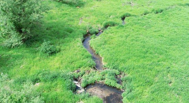
One possibility is that dead trees and garbage are damming the creek downstream from the flooded area. In 2019, the DNR flew a drone over the marsh and discovered one such blockage about 200 feet downstream of the box culvert on Highway 61, according to Andy Barta, environment analysis specialist with the department.
“This was likely debris that had washed out of the flood plain and downstream during one of the mini flooding events that the creek has experienced recently,” Barta said.
After the blockage was discovered, the DNR and the City of Boscobel began discussing a land-use agreement, which was made formal in June 2020, according to Barta. The terms of the agreement gave the city access to the state lands west of Highway 61 to “dislodge and remove the debris using camping tools as best they could,” he said.
Boscobel City Engineer/Director of Public Works Mike Reynolds was part of that effort. “Me and some other guys went downstream and spent almost a day just cutting out the debris piles that were holding the water back,” Reynolds said. “You could see that it is only a matter of time before the next tree falls down and begins to block the water.”
According to Barta, the water dropped about five inches after the blockage was removed.
“There is not a real defined stream channel out through the marshland,” Barta said. “There is also more debris as you go farther out and follow the creek. To my knowledge there are no in-depth surveys from anybody that has gone out there and fully investigated and shot water levels to really help interpret what the real cause is.”
Box culvert
Another theory of Reynolds’ is that the box culvert on Highway 61 is too small.
“Every time we get a heavy flood event, the box culvert blocks the water up and the water begins to travel north along the east side of the highway,” he said.
Reynolds explained that there are two types of streams: A cutting stream with a steep gradient that sweeps away sediment during floods, versus a settling stream, which Reynolds said he thinks might describe Sanders Creek.
“When the water gets slowed down as it enters the box culvert, all the sediment settles down. So, it could be that it is raising the stream bed,” he said.
If that’s the case, dredging the creek bottom could solve the problem. “We would need the correct permits from the DNR to do something like,” Reynolds said. “I do not think that we would explore that option until we absolutely knew that soil and sediment were settling on the bottom of the creek and filling in.”
Sinking sidewalk
It’s possible that the creek’s not rising, but the sidewalk is sinking. The section underwater was poured in 2003, according to Reynolds, and that section is considered a wetland.
“When we poured it, it was a very dry October. It is possible that the sidewalk has settled, but I do not think that is the case,” he said.
Either way, a quick fix might be to add another layer of concrete to the walkway to get it above the waterline. “I don’t know if this would be an issue for the DNR when putting in additional fill in the wetlands or not. I don’t think that it would be, but we would need the proper permits to do it.”
Citizen action
The land-use agreement between the city and the DNR expired after six months, according to Barta, but could be renewed. In the meantime, the DNR has no plans to study or solve the flowage, preferring to partner with communities on such projects.
In the meantime, Roling is taking matters into her own hands, with the DNR’s blessing to remove downed trees and abandoned beaver dams.
“That is going to take more planning,” Roling said. “That is going to take people willing to get dirty, people willing to work with a thought process.”
She’s tackled two dams already on her own, dislodging an inflatable kiddie pool, a volleyball, old lumber, and other trash. On September 11, she aims to corral volunteers to head deeper into the swamp to tackle more blockages there. An information meeting will take place at the Boy Scout cabin on August 22, 5 p.m.
Volunteers are encouraged to join the Facebook group Friends of Sanders Creek, which Roling created to help coordinate efforts to cleanup the creek.


