
MONROE COUNTY - The Monroe County Climate Change Task Force heard reports on fundraising, weather monitoring station installation, stream crossing inventory work, and an update on progress on the ‘Monroe County Climate Readiness and Rural Economic Opportunity Assessment’ project.
The day’s activities were divided into a morning meeting, and an afternoon tour of a problematic stream crossing, a weather station installation, a farm where a demonstration project would be conducted, and the Korn Dam, one of the PL-566 dams that breached in August of 2018.
Monroe County Land Use Planner Roxie Anderson reported that the county has signed up to participate in a ‘Weather Ready Nation’ program as an ambassador. This would commit the county to work with the National Oceanic and Atmospheric Administration (NOAA) to promote weather safety messages and tools.
Monroe County Emergency Management Director Jared Tessman reported that his department is also working with NOAA to participate in the ‘Storm Ready’ program.
National Weather Service LaCrosse’s Todd Shea described the difference between the two NOAA programs.
“Weather Ready Nation is like a force multiplier, helping to amplify messages to the public,” Shea said. “Storm Ready is part of the Weather Ready Nation program, but it is more intensive and requires approval.”
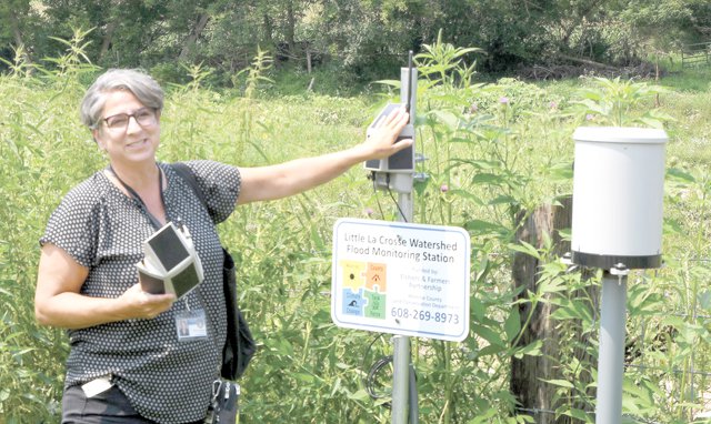
Anderson also reported that the weather stations that have been installed so far have now had their locations established with the National Weather Service. She said that her team is still working on getting the stream level sensors placed, and after that, then the data will begin to be populated to the Southwest Wisconsin Hydrology page on the NWS LaCrosse website.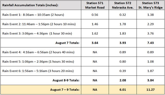

“When we received our weather stations, there was a defect in the stream level sensor unit,” Anderson explained. “They worked at first, and then they all stopped working at the same time – so the company is sending us replacements.”
As far as grants to purchase more stations, Anderson reports that FEMA has been following up with them as the grant has been moving through their process.
“That is a really good sign,” Anderson said. “The part of the process that requires an environmental review of the stations is completed, and has been published in the county’s paper of record. Our request is for $40,000, with a 25 percent match required.”
As far as floodplain buyouts, Anderson reported that all eight properties identified for buyouts in the Little LaCrosse River watershed have been acquired. Four have been demolished, and the goal is to have the other four done by September.
“From there, our department is developing an open space management plan for county board approval,” Anderson explained. “Once we have an approved plan, then we can begin to consider what entity will have final ownership over those properties.”

Crossing inventory
The Monroe County Land Conservation Department hired two interns to conduct an inventory of stream crossings in the county. Those two are Michael Yancey, a senior at the University of North Carolina at Chapel Hill, and Lily Adams, a natural resources student at UW-Stevens Point.
The two received training from the DNR in conducting the inventory. The tool they used was developed in the Great Lakes Region by Michael Rupley and the Michigan DNR, and works off of an ArcGIS platform.
There are 1,800 stream crossings in the county, and the two are expected to complete the inventory of 200 before the end of their summer work. Their work was focused first on the southernmost townships in the county, where typically the flood damages are worse.
“Overall, we found that 29.65 percent of the crossings have barriers to fish passage, there is 20.70 tons of soil erosion per year, and 39.3 percent of the structures are undersized to accommodate flood flows,” Yancey explained. “We ranked every crossing with a number between one and 100, with one being the best and 100 being the worst.

They have completed the inventory in Portland, Jefferson, Sheldon, Wellington, Glendale, Ridgeville, Wells and Leon townships. The information generated will be served in a publicly-available online format, and will be available to townships and the Monroe County Highway Department to use as a decision-making tool about what crossings to prioritize, and what kind of improvements might need to be made. It may also better position those entities to seek funding or disaster relief.

Greenfire assessment
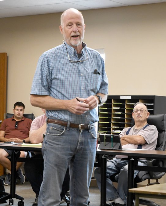
Fred Clark, Executive Director of Wisconsin’s Greenfire, explained to meeting participants that the purpose of his group is “to bring the science of natural resources conservation into policy-making.” He said that the current assessment underway in Monroe County is designed to take a 30-year look ahead.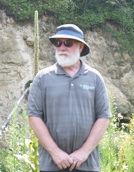

Rob Montgomery is a member of the Greenfire team, leading the ‘Climate and Hydrology’ sub-team. He is a water resources engineer, and works with Wisconsin Initiative on Climate Change Impacts (WICCI) and the University of Wisconsin.
“Looking 30 years ahead to 2050 is far enough out, but little enough to be useful,” Montgomery explained.
Montgomery discussed the updated rainfall definitions that were generated by Dr. Dan Wright and Dr. Eric Booth of the University of Wisconsin. The two used a methodology called ‘Stochastic Storm Transposition for Physically-Based Rainfall and Flood Hazard Analyses.’
This method recognizes that rainfall events in the Driftless, though they may have impacted one area or another, could have impacted either. This eliminates the restrictions of current rainfall analysis, which compares only rainfall events at a fixed point over a long period of time, and allows scientists to more accurately estimate the changing rainfall trends in a geographic region.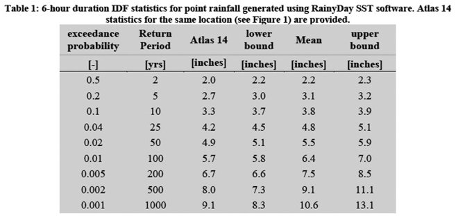

“Dr. Wright’s method uses radar data, and even though the events used in the study have only occurred across the last 15 years, the conclusions generated are effectively longer than the straight 15 years,” Montgomery said. “And it is more than just rainfall that affects flooding outcomes – it is also vegetation cover, soil moisture, and more.”
Christina Anderson with Wisconsin Land +Water is leading the ‘Climate and Agriculture’ sub-team.
“Our goal on the sub-team is to find the known tools for climate resilience and farm profitability that work best here,” Anderson explained. “In our work, we’ve recruited three farmers – Jack Herricks, Wayne Chapman and Tucker Gretebek.”
Other partners that are working with are the American Farmland Trust and the Northern Institute of Applied Climate Science. Anderson said that ultimately, their team’s goal is to create educational resources and to put real life demonstration projects on the ground.
Town of Angelo farmer Jim Leverich attended the meeting, and spoke as a farmer whose family had been on the same land since 1864.
“We’ve been here farming and observing the landscape for a long time now, and we’ve been no-till since 1984,” Leverich said. “You can implement conservation practices to the hilt like my family has done, and still when nature unleashes a huge rain, there’s only so much you can do.”
Leverich says that he prefers to use the language ‘climate awareness’ versus ‘climate change.’ He said that farmers need the urbanites to understand the limits, and he would like to see the left and the right come together around these issues.
“Farmers need to take a sustainable, triple bottom line approach to their farm businesses,” Leverich said. “Farmers need to be profitable.”
Clark told meeting participants that the next step in the process will be for community engagement. To that end, there will be a public open house in mid-September, and three community listening sessions in late September.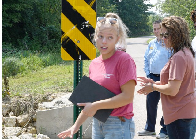

Stream crossing
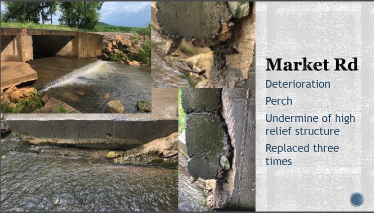
The first stop on the afternoon tour was at a problematic stream crossing in the Town of Portland. Portland Town Chairman Gary Flock met the group at the crossing, and explained the measures they had taken to upgrade the crossing after repeated storm damage.

“This crossing was constantly getting blown out,” Flock said. “We’d get FEMA funding, repair it back to the way it was, and it would get blown out again.
“We finally got sick of it, and chose to exceed what FEMA allows through disaster recovery funding,” Flock explained.
Now, he says, the crossing holds up even under large storm flows and is able to pass the water.
“We went back to FEMA after we did the work, and petitioned them for assistance in helping to pay for the upgrade,” Flock said. “As a result, we received additional funding from them.”
Flock said it had taken the town three years to make the repair, and over $100,000. He explained that they have 30-40 crossings total in their township.
Michael Yancey explained that he and Adams had given this crossing a rating of 29 out of 100, which is fairly good. They said that a perch in the construction creates a barrier to fish passage, and that older parts of the structure retained in the repair are beginning to show rusted rebar.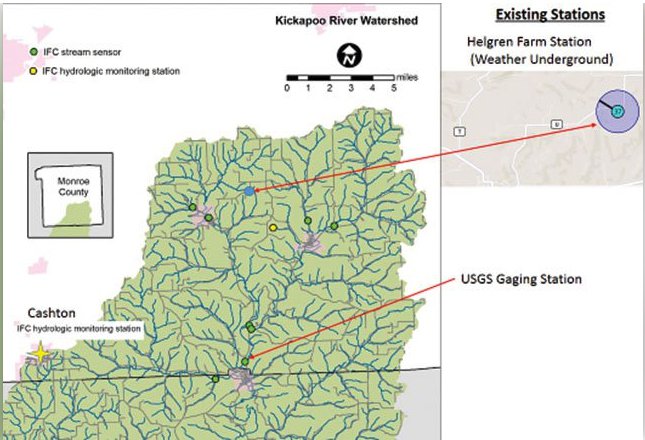

Weather station
The second stop on the afternoon tour was to view one of the weather monitoring stations installed on Nebraska Avenue at another stream crossing.
Roxie Anderson explained the process for putting the station in, and how the water level sensor cable would be run through conduit before being placed at the streamside.
“The only real problem we’ve had, aside from the faulty water level sensors, has been with pollen and bugs,” Anderson said. “We find that we need to get out in the field and clean them about once per month.”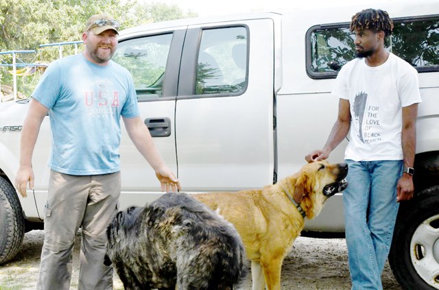

Gretebek farm
The third stop on the afternoon tour was at the farm of Tucker and Becky Gretebek. The farm was teeming with animals, from big sloppy farm dogs to wiry little Jim, the cow dog. There were dairy cows on pasture, horses, mini-goats, llamas and more.
“I went to college, got a teaching degree, and taught at Kickapoo and Viroqua school districts,” Tucker Gretebek told the group. “But one day, when I was in the classroom, I found myself envying the guy outside who was mowing the lawn. I realized that farming might be the career for me.
“We were able to purchase Becky’s family’s home farm, and eventually I saw my neighbor who was producing organically doing well, and we decided to give it a try,” Gretebek said.
“I got in contact with Organic Valley, we bought the cows, and got started,” Gretebek told the group. “It was good I had other, older and more experienced farmers around me to talk to, because it took awhile to transition cows who were used to eating grain onto a pasture-based diet, and if it wasn’t for those other farmers, I might have given up.’
Gretebek says that farm land has become very expensive because of the larger dairy producers in the area. Average farmland in his area is going for $6,000 per acre, and nearer a large parlor, it is going for $10,000 per acre. He said that he and Becky had paid $4,700 per acre for their farm a few years back.
“But the support that Organic Valley gave us made the difference between us making it or not,” Gretebek said. “It was the $4 per hundred-weight price premium that has kept us alive as a small dairy business.”
The Gretebek’s milk 50 cows, and are part of a group of nine local producers that are on the truck for milk going into Organic Valley’s Grassmilk. This product is made from milk from cows that are fed only on pasture and stored forage. He said that they feed a lot of clover and sorghum, and plant a 20-perennial seed mix into their pastures. He said that the next step for his farm is to set up a manure composting system.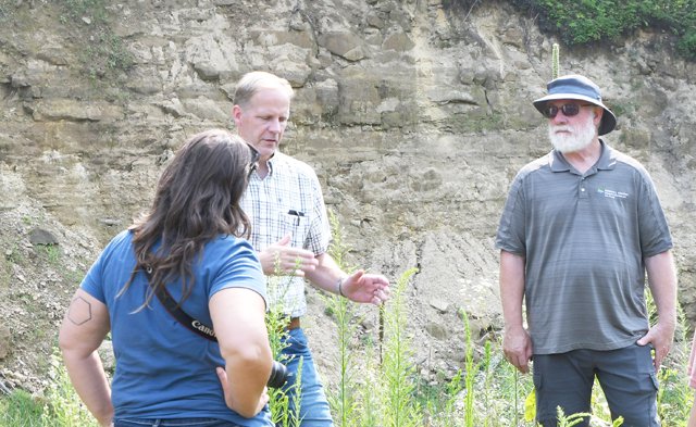

Korn dam
Monroe County Conservationist Bob Micheel led the group onto the top of the breached Korn Dam as the last stop on the tour. The dam once controlled flood waters from one of the branches of Rulland Coulee Creek, a tributary of Coon Creek.
“The whole thing went in about an hour, and the valley upstream was a wall of water,” Micheel explained. “The town road was blown out in the event, so the morning after the breach, when we came out to take a look, we had to walk down from the top.”
Micheel said that, looking up valley, all the tops of the trees were coated in mud because the water had been so high.
He told the group that with the shaping and reclamation that has already been done at the site, most of the work to decommission the dam so it can pass a 100-year storm event has already been completed. The remaining task would be to plug up the main spillway pipe.


