By allowing ads to appear on this site, you support the local businesses who, in turn, support great journalism.
Iowa “light years ahead” with flood forecasting services
Nathan Young
NATHAN YOUNG is the Associate Director of the Iowa Flood Center. Young explained his center’s leadership of the State of Iowa’s development of advanced flood forecasting services to benefit the state’s citizens.

SPARTA - During recent extreme flooding events in Southwest Wisconsin, local residents would maze around a hodge-podge of forecasting information, trying to gain an understanding of what is happening in real time. Local news, National Weather Service Hydrologic Forecasts, and even Facebook became lifelines to residents concerned about what was headed their way.

Flood control dams breached after a catastrophic rain event in the headwaters of the Kickapoo River, Coon Creek and Little LaCrosse River watersheds. Communities like Bloomingdale and Avalanche in the West Fork, Ontario in the Kickapoo River Main Stem, Chaseburg and Coon Valley in Coon Creek, and Melvina and Leon in the Little LaCrosse watersheds had little to no advance warning when tsunami-like flash floods swept into their communities in the middle of the night in August of 2018. 

Individuals camping or canoeing on the Kickapoo Valley Reserve may not receive enough warning to evacuate campsites or get off the river. Timely information from upstream is critical to public safety there.

Others downriver, anticipating river flooding, may simply be trying to determine how to protect their property or find a route to work.

Current resources to help forecasters and local first responders understand what is happening in these kinds of situations often aren’t well enough developed outside of urban centers, or for the smaller tributaries of larger watersheds. 

USGS maintains river gauges in Ontario, LaFarge and Steuben which provide information on stream flow, and the National Weather Service has a similar gauge in Readstown. These gauges provide information about the volume of water that is passing along the water body at that location, but do not provide information about the levels of water.

These challenges, and concern for public health and safety, have led the Monroe County Board of Supervisors to adopt a climate change resolution. That resolution created a ‘Climate Change Task Force,’ and that task force has adopted 10 goals. The first of those ten goals is “Implement monitoring devices (weather stations) and warning systems in real time by coordinating with emergency management and the National Weather Service.”

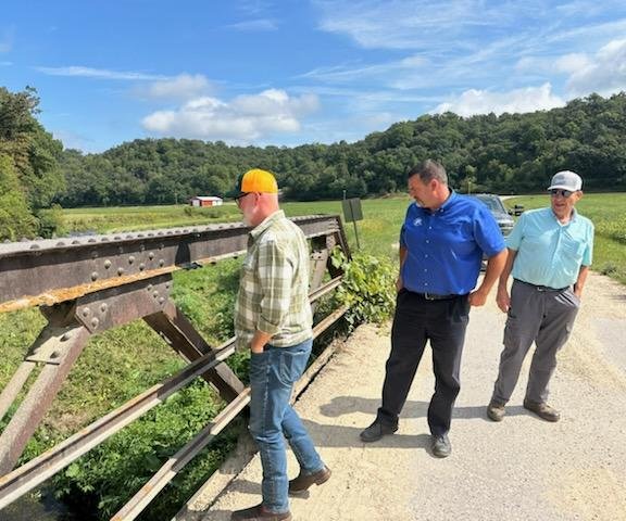
Representatives from U.S. Senator Tammy Baldwin, U.S. Representative Ron Kind, and State Senator Jennifer Shilling’s office, attended the meeting of the task force on Wednesday, Dec. 11 in Sparta. State Representative Loren Oldenburg attended the meeting in person, as did representatives from the U.S. Geological Survey, USDA-NRCS, National Weather Service - LaCrosse, and the Wisconsin DNR. The invited speaker at the meeting was Nathan Young, Associate Director of the Iowa Flood Center.

In addition to Monroe County, Climate Change Task Forces have been enacted by county boards in Eau Claire, Dane and Milwaukee counties.

Discussions are currently in progress among county conservation officials in the Kickapoo and Coon Creek watersheds about how they can collaborate around issues of flooding and public safety. Pam Porter, DNR Policy Advisor in the Governor’s office and member of the state’s newly formed Climate Change Task Force attended the meeting in Sparta.

Iowa Flood Center

Iowa has had many flooding emergencies in the last decade, and their efforts to provide more useful flood prediction information were jump started after catastrophic flooding in 2008. More than 201 miles of primary highway washed out from the flooding, and estimated damages totaled over $10 billion. Of Iowa’s counties, 86 of 99 received federal disaster declarations.

In the aftermath of the flood, legislators approached Iowa Hydroscience and Engineering Director Larry Weber about “how to prevent this kind of flooding from ever happening again.”

Weber and another professor of civil and environmental engineering, Witold Krajewski, talked with legislators and agreed to write a proposal about what their department could do to help improve that state’s response to flooding. Their proposal to create a state-funded flood center served as the basis for a law passed in 2009 creating the Iowa Flood Center (IFC). 

The legislature provides the center with base funding of $1.5 million per year. This amounts to about 50 cents per Iowan per year. These funds are used to pay core staff salaries, and to leverage additional grant funding for projects. Over the last decade of their existence, the center has taken their $13.8 million in state funding and used it to secure $127 million for flood-first projects directly benefiting Iowans. 

“Iowa is light years ahead of Wisconsin in flood preparedness,” Monroe County Conservationist Bob Micheel said. “Their work provides an example of where our task force is looking to go.”

Flood information system

Young discussed his agency’s development of the Iowa Flood Information System (IFIS). This tool gives the public easy online access to information about rainfall, river and stream levels, flood predictions, and flood inundation maps for 26 communities in Iowa. 

These resources show what a predicted flood stage will mean for homes, businesses and schools. It puts data directly in the hands of people who need it – emergency managers, public safety personnel, and the public. This information allows Iowans to make better decisions to protect their property, families and livelihoods.

To view their website and the flood prediction tools available to Iowa citizens, go to ifis.iowafloodcenter.org .

In 2010, the agency released their first community-based flood inundation maps for Iowa City, Des Moines, Cedar Falls and Waterloo.  IFC and Iowa DNR partnered with and received $15 million from the U.S. Department of Housing and Urban Development (HUD) to update floodplain maps throughout the state. Those maps show the probability, extent and depth of flooding for every Iowa stream draining more than one square mile. Each year a few more communities are added into the online tool.

The method used to update the floodplain maps, which were eventually accepted by FEMA, was to use LiDAR data provided by the Iowa DNR to map the streams. This allowed researchers to precisely map Iowa’s river and stream network, develop computer-based flood simulations, and delineate floodplains with reasonable accuracy.

The floodplain maps define the boundaries for 100-year (one percent annual chance of flood) and 500-year (0.2 percent chance) floods. Funding from the Iowa Natural Heritage Foundations allowed the team to also create maps for 2, 5, 10, 25, 50 and 200-year floods.

Upon FEMA review and approval, the maps have become regulatory. Updating the maps has helped communities to more accurately assess which residents require flood insurance and what their premiums should be.
IFC Hydrologic Stations
HYDROLOGIC STATIONS like the one shown here will be placed in every county in Iowa in the next few years. The station’s gather data about rainfall amounts, wind speed, soil moisture and groundwater levels which are fed into an online flood forecasting tool.

Stream sensors

The Iowa DNR also contracted with the IFC in 2010 to build and deploy a network of 50 stream sensors. Students built the initial prototype of the instrument, which measures stream height via ultrasonic sonar. The instruments’ measurements are uploaded every 15 minutes into the IFCs online tool. Funding for an additional 50 sensors was provided in 2012. In 2014, another 50 stream sensors were deployed, bringing the total number to 200. By spring of 2019, that number had increased to 250.

These stations are placed in locations on bridges where USGS does not locate their gauges, providing more localized forecasts. Each station costs about $3,500. The stations are much less expensive than those deployed by USGS, allowing for a broader distribution.

Hydrologic network

In 2013, IFC and NASA partnered on a project that would provide additional crucial pieces of information into their online tool – rain gauges to measure local rainfall amounts. These gauges were deployed along with soil moisture and temperature probes. The stations also feature a shallow monitoring well to measure the water table. The first pilot project took place in the Turkey River watershed. 

Student researchers work with NASA to compare the sensors on the ground to the results of NASA’s Soil Moisture Active Passive (SMAP) satellite. In 2018, IFC deployed another 20 stations and received requests from over 100 partners across the state. These stations cost about $15,000 apiece to deploy, and IFCs goal is to place one in each of Iowa’s counties.

This has provided invaluable information to weather forecasters and added a dimension to the information available on the IFC’s website. But the information is also very valuable to farmers, and some of the hydrologic stations are located on farms. The information allows farmers to learn when the soil is ready to plant, the best time for field applications, and how to plan for changing weather conditions.

Watershed approach

Iowa also received $8.8 million from HUD for the Iowa Watersheds Project (IWP). That program is overseen by the IFC, and established the first watershed management authorities (WMAs) in Iowa. Authority for WMAs is granted by statute. Projects are limited to HUC-8 watersheds or smaller. The WMA is a self-governed non-profit, and individuals from municipalities, counties, and soil and water conservation districts can sit on their boards.

Their purpose is to establish small-scale flood mitigation projects in sub-watersheds. Creating the authority allows counties and municipalities in a watershed to work together to obtain funding, and to implement watershed-based projects. 

In 2016, Iowa received a $97 million grant from a HUD-Rockefeller Foundation National Disaster Resilience Competition to implement a project called the ‘Iowa Watershed Approach’ (IWA). Projects were completed for the first five watersheds in 2016.

By spring 2019, IFC researchers had completed hydrologic assessments in each of Iowa’s watersheds.  These assessments include the watershed’s hydrology, geology and soils, topography, and land use. These assessments are used to create models of flood reduction and water quality improvement impacts from installation of conservation practices.

With the information from these assessments, project coordinators engage with volunteer landowners (who are eligible for 90 percent cost-share) from USDA-NRCS to strategically site conservation practices such as ponds, terraces and wetlands. These projects, launched in 2019, are designed to reduce downstream flood impacts. So far, project coordinators are working with 125 landowners to identify sites for nearly 480 practices across eight watersheds.
Land Conservancy celebrates 25 years
Driftless Area
DSC_9176
ROSE AND JIM SIME were present for the Driftless Area Land Conservancy’s 25th Anniversary celebration on May Day. The two are the conservation easement partners in DALC’s most recent acquisition – The Big Rock Preserve. The 140-acre property near Castle Rock in Grant County is located in the heart of the Snow Bottom State Natural Area. As Jim Sime explained, “it was always the plan to protect Big Rock from development, and to hand it off to someone who could care for it.”

The Driftless Area Land Conservancy gathered to celebrate their successes and share their plans for the future to a packed house at Wintergreen Resort on May Day. The Conservancy (DALC) is working to raise funds to purchase the Wintergreen Resort and establish it as the trail head for their 50-mile ‘Driftless Trail.’

Three speakers provided comments to the 400 people present for the celebration – Jordy Jordahl, Jen Filipiak, and Mark Cupp.

“I am humbled and honored to have been the DALC executive director during our awkward teenage years,” DALC executive director Jen Filipiak said in her address to the group. “Now, our organization is coming of age, and with lots of strategic thinking and planning, we’re about to make a big transition and step up to meet the hopes and dreams of our community for the next 25 years.”

“I want to tell you all that when we started this organization back in 2000, I don’t think any of us expected to be here today with almost 400 people and be able to say that our land trust has protected almost 10,000 acres, own seven preserves, is actively working to build a 50-mile walking path, and is now working to protect this gem on the bluff over the Lower Wisconsin River!” Jordahl enthused.  “And in addition to the folks here, there are many members and supporters who couldn't join us today!  Wow. I had some high hopes but wow.”

“All affiliated with DALC should be proud, incredibly proud, of the accomplishments we’ve heard ticked off today,” Lower Wisconsin State Riverway Executive Director Mark Cupp observed. “This is rare. Not every organization has this level of success, and is able to sustain it and continue to grow. Look around. Hundreds of people have gathered today to celebrate DALC’s 25th Anniversary, and last week, Governor Evers visited Wintergreen Resort to learn more about DALC’s work, recent initiatives, and those on the immediate horizon. The best is yet to come – I can feel it in my bones.”

Mixed in with the exhibits detailing key milestones of the group’s first 25 years and booths inviting interaction with partner organizations, was information lauding the positive impacts of the Knowles-Nelson Stewardship Program. The State of Wisconsin program has funded parks and trails, protected lakes and rivers, and conserved special places across Wisconsin for over 30 years.

Through this funding, up for reauthorization in the state biennial budget for 2025-2027, 750,000 acres have been protected, and more than 4,200 grants have been awarded to local governments and non-profit organizations to support parks, trails, boat launches and campgrounds.

Overall, in the last 30 years, this represents a $1.3 billion investment in Wisconsin’s land, water and way of life, and is estimated to cost each Wisconsin taxpayer only $11 per year. Supporters say that through this investment, $2.5 billion is returned to state residents every year through air and water filtration, carbon sequestration, recreation opportunities and flood protection. In addition, the funding supports 96,000 outdoor recreation jobs and the state’s $24 billion forestry economy.

Key milestones

• 2000-2005: DALC got its start in the year 2000 when a group of dedicated individuals gathered in Richland County. That group developed a collective vision to protect land and preserve the unique landscape and ecosystem of the Driftless Region. In 2001, they became a non-profit with a passionate team of volunteers. By 2003, they hired their first staff member, Doug Cieslak, as executive director and completed their first conservation easement. In 2005, DALC partnered with Prairie Enthusiasts and DNR using NRCS funding to protect farmland – a groundbreaking step that set the tone for future collaborations.

• 2006-2010: Despite the economic challenges of the 2008 recession, DALC persevered with safeguarding of vital lands. During these years, DALC employed two staff members, and had protected 2,287 acres. By 2010, they succeeded in protection of their largest parcel – the 548-acre Schuelke Easement. The effort was part of a broader initiative to connect properties within the Military Ridge Prairie Heritage Area.

“I can’t imagine a better place to live. I’ve seen so many beautiful farms disappear, and this was my chance – our chance – to make sure that our family says ‘thank you’ to those before us, and those to come, by making sure it will never become a sea of houses or paved over,” conservation easement partner Wayne Schuelke said.

• 2011-2015: Now with five staff members and 5,860 acres protected, DALC’s reach expanded. During these years, they protected six contiguous conservation easements, collectively known as the ‘Dry Dog Ranch’ in Iowa County. In 2012, they acquired the Erickson Conservation Area, their first owned preserve, and extended their efforts into Green and Lafayette counties. By 2015, DALC completed the Lowery Creek Watershed Plan, underscoring their focus on community centered ecosystem-level preservation and watershed health.

• 2016-2020: In these years, DALC relocated their offices, launched the Bloomfield Prairie Partnership, and publicly opposed the Cardinal Hickory Creek Transmission Line. In 2017, DALC earned the prestigious Land Trust Alliance accreditation and was named Wisconsin Land Trust of the Year. This recognition coincided with the formation of the Driftless Trail Advisory Team, a testament to DALC’s commitment to creating publicly accessible natural spaces. By 2020, in the midst of the pandemic, the group expanded their portfolio with the Wild Oaks Preserve in Dane County, and established Iowa County CLEA-N, responding to the community’s desire to work on locally sourced and locally used clean energy.

DALC’s vision for the Driftless Trail is a 50-mile hiking trail, hosted mostly by private landowners, that creates a corridor for land conservation, climate resiliency, exercise, education and connecting with nature. Though the trail is a long-term project that will take many years to complete, multiple trail segments are open now, including the Weaver Road Trail, a 1.1-mile loop located just north of Governor Dodge State Park, the Welsh Hills Trail, a two-mile loop on the Taliesin property, the Phoebe Point Trail, a 1.1-mile loop offering stunning overlooks of the Wisconsin River, and the Knobs Road Trail near Mill Creek. For more information and maps, go to www.driftlessconservancy.org.

• 2020-2025: During the last five years, DALC has grown to 11 staff members, and 9,550 acres protected. They facilitated their first land protection assist with Ringelstetter Wetland, which was later donated to the DNR. In 2023, they secured ‘Grasslands of Special Significance’ funding from the federal government for a conservation easement, and by 2024 had hired a development director and acquired two more properties – Dragon Woods and Big Rock.

Giving thanks

Jordy Jordahl was among the group of folks who came together to form the Driftless Area Land Conservancy, and served on the initial board until 2003. Over the last 25 years, Jordahl has worked on projects to protect special places like the Baraboo Hills, Lower Wisconsin Riverway, Military Ridge grasslands, and the Mississippi River watershed, while working as policy advisor to the Governor, legislative policy aide, director of intergovernmental relations for the Wisconsin Department of Administration, and for The Nature Conservancy.

Jordahl kicked off the 25th Anniversary celebration, giving thanks where thanks are due.

“Wow, what a great day in the Driftless,” Jordahl exclaimed. “I want to start by thanking the event sponsors, and the staff and volunteers of DALC for their hard work to make this celebration happen. I particularly want to thank Terry and Suzanne Shifflet, the owners of the Wintergreen Resort where we are gathering today, for allowing us to celebrate in this amazing place.”

Jordahl said that DALC is “all about the land,” but said that his comments would really be more about the people. He thanked the founding members of the group,  Gathering Waters, Wisconsin’s alliance for land trusts.

“The support of Gathering Waters has been instrumental over the years,” Jordahl stated. “We wouldn’t have been able to do what we’ve done without their support.”

Jordahl also thanked DALC’s conservation partners, like the Nature Conservancy, Mississippi Valley Conservancy, and countless others.

“None of our key milestones would have happened without people working together,” Jordahl said. “And, the landowners we’ve partnered with have brought the land to the land trust. Owning land means caring for the land, and so that means we also need to thank our many volunteers, without whom our work wouldn’t be possible. It takes a community to protect a landscape.”

Jordahl said that Governor Evers, during his Earth Week visit to Wintergreen Resort, agreed that “we have to work together to protect places like this.” Jordahl explained that DALC is currently fundraising for $6 million to purchase the Wintergreen Resort.

Accomplishments

DALC’s Executive Director Jen Filipiak followed Jordahl’s comments, and touched on several big projects that the group had worked on in the last few years.

“We opposed construction of the Cardinal-Hickory Transmission Line after folks in our area asked us to do so,” Filipiak said. “Even though that transmission line is now up and running, the rallies we held were the biggest events we’ve ever held, and our efforts resulted in several modifications to the route so that it doesn’t cross conservation easements, and we’re still in court opposing the line’s crossing of the Upper Mississippi River Fish & Wildlife Refuge.”

Filipiak waxed particularly enthusiastic about their group’s development of the Driftless Trail, a walking trail intended to connect the Lower Wisconsin Riverway to Mt. Horeb and Governor Dodge State Park.

“In planning for the trail, we undertook a feasibility study with the National Park Service, and found out that, yes, we could do it,” Filipiak said. “In southern Wisconsin, 97% of the land is privately owned, so there’s a need for publicly available spaces.”

Filipiak said that the Driftless Trail encompasses “our entire mission in one project,” and enthused that “maybe one day the main trail head can be right here at the Wintergreen Resort.”

A worthy project

Last up to speak was Mark Cupp, executive director of the Lower Wisconsin State Riverway Board.

“I offer my sincere gratitude to the DALC founders for their vision, and the current and former board members for their continuing commitment to a vision for conservation in the Driftless,” Cupp said. “I offer my sincere gratitude to Jen and her team, and all former DALC staff members, for their commitment, their energy, their sacrifices, blood, sweat and tears in making DALC a great success. To the landowners, donors, partners, and supporters of DALC for the last 25 years, my thanks as well.”

Cupp pointed out that the Wintergreen Resort is located in the Lower Wisconsin State Riverway, a 92-mile riparian corridor and 10,000 acre property of both public and private lands extending from Prairie du Sac to Prairie du Chien.

“Thank you to Terry and Suzanne Shifflet for your incredible patience in working to fulfill your vision for the Wintergreen Resort, to ensure that it will be a place to be enjoyed by the public, and not a playground for the affluent,” Cupp remarked. “At this hour, on this first day of May 2025, I am optimistic that this special place will be acquired by DALC, and will become a destination within the Riverway.”

Cupp said that the Wintergreen Resort is one of the top three, if not the number one priority acquisition remaining in the Lower Wisconsin State Riverway. Reasons for that, according to Cupp, include aesthetics, native plant communities, fauna, wetlands, a mile of undeveloped shoreline, trails, and a building with potential that is “limitless.”

“However, we need to ensure that the dream is realized – we need to push to the finish line, and raise the necessary dollars to achieve the goal,” Cupp stated. “We need to support reauthorization of the Knowles-Nelson Stewardship Fund, we need to speak to legislators and local officials, and our friends and our neighbors about the importance of this acquisition.

“There’s a lot of negative noise in the world these days, and frankly, I have to tune it out and focus on other things – things I can change, things in my sphere of influence,” Cupp said. “These things include the Riverway or the family farm – places where I can find a refuge.”

Cupp said that in a recent moment of reflection, he thought of a favorite passage from Wendell Barry, ‘The Peace of the Wild Things.’

“This is why we need places to go to restore our soul, to calm our psyche, to hear a bird sing or see a Pasque flower in bloom,” Cupp said. “A place such as Wintergreen, or Big Rock, or the Driftless Trail. This is why we bond together and fight for those things in which we believe – to leave this world a better place for the next generation, and the generation after that.”

DSC_9277
JEN FILIPIAK, executive director of the Driftless Area Land Conservancy, speaks to a capacity crowd at their 25th Anniversary celebration on May Day. The event was held at the Wintergreen Resort, a property DALC is working to acquire.