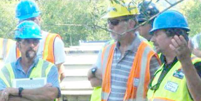

VIROQUA - At the first of the Valley Stewardship Network’s ‘Conservation on Tap’ series, Dave Vetrano, retired Wisconsin Department of Natural Resources (WDNR) fisheries biologist, and Heidi Keuler, Fish Habitat Biologist and Fishers & Farmers Partnership Coordinator with the U.S. Fish and Wildlife Service out of LaCrosse, spoke about the past and the future of the Coon Creek watershed.
Both have a history with the watershed. Vetrano worked as a WDNR fisheries biologist out of the LaCrosse office for more than 30 years. In his time on the job, he was instrumental in restoration efforts. Keuler grew up on a farm along Coon Creek, and graduated from Westby High School.
The next topic in the ‘Conservation on Tap’ series will be Prehistoric Ecology of the Driftless Area by John Delaney, Agroecologist, Valley Stewardship Network. The event will take place at the Rooted Spoon in Viroqua on Wednesday, Nov. 14, at 7 p.m.
Coon Creek project
Coon Creek, running southwest through Coon Valley, Chaseburg and Stoddard on its way to the Mississippi River, is considered to be one of the top 100 trout fisheries in the nation. With its headwaters in Monroe and Vernon counties, it was also one of the areas hardest hit in the catastrophic August 2018 rain event near the Vernon and Monroe county border. Three flood control dams in Monroe County’s Portland Township breached and sent a tsunami of flash flood waters crashing down the coulees in the wee hours of the morning on August 28.
The Coon Creek Watershed has an iconic history as the birthplace of watershed-based conservation farming in the United States. A monument in a park in Coon Valley, along the banks of Coon Creek, commemorates the momentous restoration of the damaged landscape, where deforestation and farming practices had resulted in erosion of the topsoil and degradation of the water:
“In the early 1930’s, conservation projects were established in the Coon Creek Watershed that altered land use practices and led to the formation of the United States Soil Conservation Service. This monument is dedicated to the combination of cooperating landowners, dedicated technicians, and conscientious laborers, whose efforts made the Coon Creek Project an example for farmers worldwide. May the commemoration of these pioneering people serve to perpetuate the cause of soil conservation for all time.”
The sign is placed on two stonework wings that marked the entrance to the Civilian Conservation Corps camp established in the Coon Creek Watershed in 1934.
History of land use
Major European settlement in the Coon Creek Watershed started in the 1820s with logging, and agricultural activity in the 1850s with the advent of the moldboard plow. By 1880, dairy was the major industry. Settlers had imported a style of dairy cow management where they grazed the sloped hillsides.
“Grazing those hillsides which had so recently been logged resulted in compaction of the soil, which reduced water infiltration,” Vetrano recounted. “What most people don’t realize is that most water infiltration occurs on the slopes and not the hilltops.”
The result was catastrophic runoff and creation of epic gullies. By the 1900s, flash flooding became a chronic problem with at least one major flood per year. Catastrophic floods occurred in 1907, 1912, and 1917. When another major flood hit in 1935, soil loss was estimated at 1.8 million tons.
“First there were rills, then gullies, and then essentially, canyons,” Vetrano explained. “In just 70 years, the fertile land was reduced from pristine to the brink of agricultural uselessness.”
By the mid 1930s, 12-15 feet of sediment had been deposited into the watershed’s valleys. Streams became wider and shallower, water temperatures rose, and the population of native brook trout was “extirpated.”
“For these reasons, the Coon Creek watershed was selected by the newly-formed U.S. Soil Erosion Service (became the Soil Conservation Service in 1935) as the first demonstration project in the nation,” Vetrano explained. “The project was intended to show farmers that conservation could work to save soil and their farms.”
Vetrano explained that the conservation initiative has mixed reviews in the farming community, and some would only sign limited term contracts. Conservation practices employed included terraces, contour strips, reforestation of hillsides, check dams and creek bank stabilization.
Even with the improvements made in the 1930s and 1940s, with lack of water infilitration, springs that were not recharged had reduced or stopped flow. Creeks changed course, water temperartures rose, and a fisheries biologist in the 1950’s was quoted as saying “because of watershed management problems, trout stream fishing in the Coulee region may practically disapper.”
Habitat improvement
When the flood of 1978 hit, it destroyed most of the habitat improvements made up until that time. In that year the Trout Stamp Act provided funding to kick off an expanded trout habitat improvement program in Wisconsin. Vetrano began his work in the watershed around this time, and worked closely with local Rod & Gun Clubs.
“In 1978, Coon Creek was 150 feet wide and three inches deep,” Vetrano said. “There was no natural reproduction happening, and it was a put-and-take stream, with stocked brown trout which are basically pigs with fins.”
Vetrano explained that in the 1980s there was a push to restore the fishery through new habitat technology and methods. In that work ‘lunkers’ (crib-like, wooden structures installed along a stream bank to create overhead cover and resting areas for fish) were employed, as well as sloping of the creek banks 4:1 to reconnect the stream to the floodplain to slow flood waters down and reduce destruction and erosion. The banks were then planted in perennial vegetation, further stabilizing it.
“In those years we saw a huge uptick in Conservation Reserve Program (CRP) enrollments which required producers receiving the subsidy to follow conservation plans on their land,” Vetrano explained. “From 1983 to 1988, land under conservation tillage in the valleys increased over 700 percent.”
Vetrano said that this trend caused increased water infiltration and spring base flow, reducing temperature in the streams. For the first time, there was natural brown trout reproduction which increased enough to eliminate the need for stocking. In the mid-1990s, a program of reintroduction of native brook trout commenced. This marked the first time in a century that the once native species was able to survive and reproduce in streams where it was once abundant.
“Between 1995 and 2010, conservation professionals and enthusiasts succeeded in adding 395 miles of trout streams in the Driftless Region,” Vetrano said. “Unfortunately, only 50-60 percent of the local streams were showing this remarkable improvement, with others still plagued with the same problems seen 65 years before.”
Vetrano told participants that with the decline of dairy and rise in row crop farming, many of the old strip crops and terraces have been removed. This trend was supersized in the mid 2000s when the price for corn went to $7/bushel, and the price for soybeans went to $15/bushel, and ‘Use Value Assessment’ for farmland has resulted in more landowners grazing their woodlots again.
“Because of all these forces working together, we’re starting to see a resurgence of the old problems we were seeing a century ago,” Vetrano said. “We’re also seeing less water infiltration in ridgetop lands managed with no-till and wooded hillsides, and with increasingly large rain events, we are seeing increased quantity and velocity of waters running off. When you double the velocity of water, you increase its power to move things 64 times.”
Vetrano emphasized that in the hills-and-valley terrain of the Driftless Region, he sees the most promise for the future of agriculture and the trout fisheries in managed grazing.
While overall he sees the current condition of the area’s trout fishery as good, he is concerned about what the future holds.
“Many climate forecasts predict a much different Wisconsin in the near future,” Vetrano explained. “By 2030, our summers could resemble Illinois temperatures; by 2095 our summers could resemble Arkansas temperatures, and our winters could resemble Iowa’s.”
A future vision
Heidi Keuler grew up in the Coon Creek Watershed with legendary tales of the work of Dave Vetrano and other colleagues like Jeff Hastings. She went on to pursue a career similar to theirs. Now she is raising a family in the area as well, and talked with event participants about her vision for the future of the Coon Creek Watershed.
Her talk, titled “Engaging the Next Generation,” addressed a combined vision of more “conservation on the land,” and restored streams developed for mixed use trout fishing as well as aquatic sports. Paddling sports are the fastest growing outdoor activity, Keuler noted.
Keuler talked about her work coordinating the Fishers & Farmers Project for the Upper Mississippi River Basin. The group follows the lead of those who went before, such as Vetrano, in fostering partnerships between conservation professionals and farmers. Their work focuses conversations and initiatives on an agronomic viewpoint, and enlists farmers as essential partners in achieving conservation and fishery improvement goals.
“A two percent increase in soil organic matter will hold 32,000 gallons of water or 21 percent of a 10-year storm,” Keuler explained. “A five percent increase will hold 80,000 gallons of water or 53 percent of a 10-year storm.”
For Coon Creek, the location of so many of her best childhood memories, Keuler expounded a vision of a stream restoration project designed to increase access for trout fishers and paddlers.
“My basic plan idea is for WisCorps and partners to clear the large woody debris and box elder from the stream corridor, leaving the oaks, with funding secured for one to two years,” Keuler explained. “After this basic work is completed, Trout Unlimited and WDNR will come in to do habitat work, and work with landowners to secure access.”
Keuler emphasized that the focus of the project would be to engage youth with the work, and the recreational opportunities that will result. Partners will then be able to hold fishing and kayaking guided trips for local high schools and farmers using funds secured from grants. Issues she foresees include resolving issues that arise between anglers and paddlers, and fencing issues.


