DRIFTLESS - Perhaps it’s no surprise that Monroe County, located in the headwaters of the Kickapoo, Baraboo, and the Little LaCrosse Rivers, and Coon Creek, is taking the lead in fostering citizen discussion about the flood control dams that breached on August 28.
More than 50 citizens participated in a discussion about the dams future at the Town of Portland Hall on Wednesday, Oct. 3. The meeting was led by Monroe County Conservationist Bob Micheel, and Zoning Administrator Alison Elliott. Also in attendance at the meeting were Monroe County Emergency Management Coordinator Darlene Pintarro, Monroe County Board Supervisor James Schroeder, Town of Portland Chairman Gary Flock, Town of Portland Supervisors Nick Butzler and Bob Brown, and Town Clerk Dave Milne. LaCrosse County Town of Washington Chairman Dan Korn, and Karrie Jackelen from U.S. Representative Ron Kind’s office were also present.
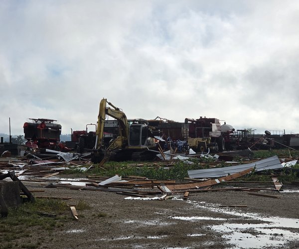
After receiving 5-12 inches of rain in six-to-eight hours overnight on Monday, August 27, six of the seven dams located in Monroe County, Town of Portland (just west of Cashton), overtopped, and three breached. Those dams all control floodwaters in the Coon Creek watershed. Two other nearby dams in Vernon County, just east of Cashton and south of the Monroe County line, in the headwaters of the West Fork of the Kickapoo River also breached in the same time frame. Those two dams were the Jersey Valley and Mlsna dams.
Micheel explained to the group that in LaCrosse, Monroe and Vernon counties there are a total of 32 PL-566 flood control dams. Twenty-two of those structures are located in Vernon County.
“The reason those dams breached is that they received an amount of rain in just six-to-eight hours that they are designed to receive over 24 hours,” Micheel explained. “There’s no question that our climate is changing, the rains are getting bigger, and the Driftless Region is getting beaten up badly.”
Micheel detailed that in the eleven years since 2007, the region has had 16 significant flood events, and six to ten in Monroe County alone. The average temperature has increased by two degrees, and there is increased evaporation which is fueling the bigger rains.
“The reason the smaller dams uphill from the ones that failed held is because they are anchored to clay,” Micheel explained. “The bigger dams lower in the valleys are anchored to sandstone, and that is always where they breach.”
Consensus to repair
Micheel explained to the assembled group that Monroe County, like Vernon County, has been given six months to make the decision to either repair or abandon the breached and damaged dams.
“Either way – with repair or abandoning the dams – it’s going to cost the county big money,” Micheel said. “There are different pots of money available to help from FEMA, USDA-NRCS, WDNR and private grants to help defray costs, but the county is going to have to help pay as well.”
Micheel layed out what he viewed as four options for the future:
1. Rebuild the dams
2. Rebuild the dams to new specifications with increased costs
3. Take a new watershed approach
4. Develop a new watershed plan for Coon Creek
Near the end of the meeting, after a lively discussion, consensus was that Coon Creek and other watersheds with their headwaters in Monroe County needed a watershed study, and an updated watershed plan. The group also agreed that the dams should be rebuilt, probably to new specifications.
“Now we’ve all come here and learned about the damages and shared opinions about what should happen. What will happen next,” one citizen asked.
“The citizens are going to be the push in the decision-making about the future of the dams,” Micheel said. “We will schedule another meeting after we begin to receive more information about the studies of the damages, what kind of assistance we might receive, and what the costs of different options would be.”
Similarly, in the 1958 Vernon County Soil Conservation District Report, written at the beginning of the heyday of flood control structure construction in the area, it reads:
“A quad-county organization of town chairmen was formally organized in the spring of 1958. This includes Crawford, Richland, Monroe and Vernon counties. The purpose of the organization is to coordinate conservation and flood control activities for the entire Kickapoo River and to work with Soil Conservation Service, Army Engineers, the Wisconsin Conservation Department, FHA and Agricultural Stabilization and Conservation in furthering flood control work.”
In the same one-page report, it was explained that there were currently four watershed organizations operating: West Clinton (became West Fork Kickapoo River in late 1958), Coon Creek, and North and South Fork Bad Axe River.
The report discussed the work of West Clinton, which began in 1953, Coon Creek which began in 1956, and the Bad Axe groups which began in 1957. The first two dams in the area, Mlsna and Klinkner, were built just south of the Vernon-Monroe county line in 1956 as a pilot project on the basis of 50 percent or more of the lands above the proposed structures being enrolled in Soil Conservation District soil conservation programs.
Watershed council leaders that came before determined the importance of citizen input, and the need for cooperation throughout the watershed. Perhaps there is a need to reinstate such a cooperative council, or to hold more citizen-input forums throughout the impacted areas
Discussion
Joe Shaitel of Leon kicked off discussion of the future of the dams at the meeting. Leon is located in the Little LaCrosse River watershed, and not Coon Creek.
“If we don’t reconstruct the dams, then we’re going to get the floods,” Shaitel said. “Valley people need the dams to be fixed. Maybe we should forget the big dams, and replace them with smaller, stabilizer dams. Maybe the Natural Resources Board needs to come out and take a tour of our area so they understand the problems we have here.”
Another citizen, Glen told the group that he watched the Luckasson Dam being built when he was a youth.
“When I was growing up, we’d lose our fences to flooding every year,” he said. “I’m concerned about how the dams are being maintained, and about the kind of land use there is above them.”
A woman present at the meeting queried Micheel about how often the dams are inspected.
“We go out and inspect the dams after flooding events, and every year in the spring and the fall,” Micheel explained. “The breaches and overtopping could not have been prevented by maintenance given the unprecedented rainfall we experienced.”
Another man present at the meeting asked Micheel if the dams were just “ticking time bombs.”
“The dams were not designed to withstand the size of the rainfalls we’re increasingly seeing,” Micheel responded. “What we’re doing right now are temporary fixes designed to route water away from the weak spots where the dam meets the sandstone hillsides.”
One man shared that his family had spent some time out in Glacier National Park this summer.
“I walked across a lot of dams out there, and they were all made of concrete,” he said. “That area can get 40 inches of snow in a winter, and it melts in the spring and those dams hold.”
Micheel responded that Vernon County had recently repaired one of their dams with a new, “state of the art,” concrete spillway. He said that federal engineers will be involved in helping to make recommendations for the damaged dams now.
“We don’t just get these rains anymore in the spring, summer and fall,” one citizen observed. “I remember last year in January when we got rain on top of a snow pack, and all that water just ran off because the ground was frozen. This could happen in the winter too.”
Another woman shared her view that water is getting to the dams faster now than it used to. “There’s too much bare dirt up above the dams, and most of the old contour strips have been taken out.”
Another man present at the meeting advocated for developing an updated watershed plan. “Whether we rebuild the dams or don’t, we can’t afford to put all of our eggs in one basket.”
LaCrosse County Town of Washington Chairman Dan Korn was there to weigh in on the future of the dams.
“The water from Portland Township winds up in Washington Township,” Korn said. “Please rebuild the dams.”
There was discussion of what kind of private and public assistance could be expected.
Monroe County Emergency Management Director Darlene Pintarro explained that all the numbers have been crunched, and provided to FEMA. Karrie Jackelen from Congressman Kind’s office said, “At this point, we are waiting for Governor Walker to ask President Trump for a declaration of disaster.”
Breached or damaged
Micheel gave meeting participants an overview of the damages to the Monroe County Dams in the Coon Creek watershed.
The three dams that breached were the Luckasson Dam, built in 1963, and the Bilhovde and Korn Dams, built in 1961. In all cases, they are almost identical to Jersey Valley and Mlsna, which breached in the West Fork of the Kickapoo River. The large breaches occurred where the dam abuts the sandstone of the hillside, near the emergency spillway.
“Based on examining the site after the breach, we determined that the Luckasson Dam gave way suddenly on Tuesday, August 28, at about 2:15 a.m.,” Micheel explained. “The Bilhovde and Korn Dams, on the other hand, gave way gradually.”
Dams that were damaged and require immediate repairs include the Peterson Dam (Coon Creek 24), and the Baltz/Amundson Dam (Coon Creek 25). Both experienced the beginnings of the erosion of the area where they abut to the sandstone hillside, similar to Ostrem and Hidden Valley in Vernon County.
Micheel also gave participants information about the Tri-Creek Dam above Norwalk in Monroe County. This is the only PL-566 dam in the Main Branch of the Kickapoo River. The wet dam was completed in 1976, with a height of 52 feet. When full, the impoundment behind it holds 393,601,190 gallons of water.