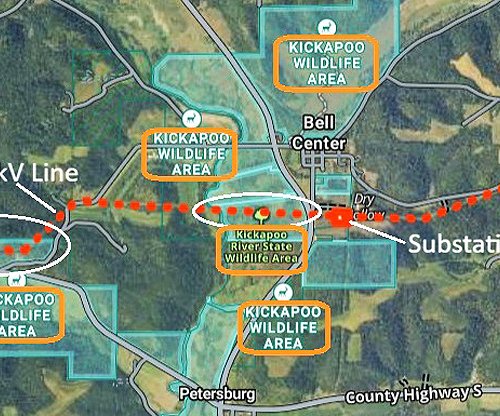
DRIFTLESS - The Independent Scout’s readers may have enjoyed Wisconsin Geology and Natural History Survey’s (WGNHS) Eric Carson’s talk about the Mississippi River last summer in Ferryville. Carson came back to the area on February 26 to give another fascinating talk about the history of the Kickapoo River and the glaciers that missed the Driftless Area. The talk attracted almost 100 citizens at the Kickapoo Valley Reserve.
In his ‘A Geology Tour in and around the Kickapoo Valley’ talk, Dr. Eric Carson described himself as a ‘geomorphologist,’ which is someone who studies the history of glaciers and river systems. Other of his colleagues at WGNHS study the bedrock, but Carson’s interests keep him focused nearer to the surface of the planet.
Driftless and glaciers
“The Driftless Area in Wisconsin and Jo Daviess County, Illinois, was never glaciated according to any credible evidence,” Carson said. “It is an old landscape that has evolved over several million years, and was formed by rivers cutting down into bedrock.”
Carson showed participants an image of the last three glacial periods that had covered most of the upper Midwest, but had all missed the Driftless Area. The most recent was the Wisconsin glaciation, about 30,000 years ago. Before that, it was the Illinoian glaciation between 130-300,000 years ago; and before that, the Pre-Illinoian glaciation, between 500,000 and 2.5 million years ago.
The bedrock in the never-glaciated Driftless was laid down between 470 and 500 million years ago, according to Carson. The Cambrian layer is older, with the more recent Ordovician layered over it.
“From observing the valleys created by rivers eroding bedrock in the Driftless, we can see the attributes of the various layers of bedrock,” Carson explained. “The valley walls descend in staircase-like formations, and these give an indication of the degree to which those rock layers were resistant to erosion.”
The main layers of bedrock that Carson said are significant in the Driftless landscape are the Wonewoc formation, the Tunnel City formation, and the Prairie du Chien formation. The Wonewoc formation can be viewed on cliffs overlooking the Kickapoo River; the Tunnel City formation is visible on sloped hillsides; and the Prairie du Chien formation is generally at the top of the landscape.
Mapping the Driftless
Carson, who was hired 12 years ago by WGNHS, has the Driftless as his particular area of study. In his work, he combines LIDAR imagery, core sampling of the soils above the bedrock layer, and extensive site visits, to develop a clear picture of the processes that formed the geology of the region.
LIDAR, which stands for Light Detection and Ranging, is a remote sensing method that uses light in the form of a pulsed laser to measure ranges (variable distances) to the Earth. The maps generated by LIDAR have largely replaced the old topographic maps because they provide much greater detail and accuracy.
“The digital elevation models generated through LIDAR are accurate down to a 2-5 centimeter level,” Carson said. “This contrasts with the old models, which were accurate only to within 10-20 feet.”
Carson displayed LIDAR maps for Crawford, Vernon and Richland counties, and for Grant County. He explained that the landscape is much more deeply incised (meaning cut into) in Crawford, Vernon and Richland. The landscape in Grant County, by comparison, he described as undulating (having a smoothly rising and falling form or outline).
Years of work
One of the key initiatives for Carson’s work with WGNHS in the Driftless Area has been to create detailed maps of the counties. In 2019, his team completed mapping of Crawford, Vernon, Richland counties. Those maps are currently undergoing peer review, and will be released in middle-to-late 2020 after that process is complete.
Carson reports that the work on Monroe County is a little over half done, but with how priorities for mapping have evolved since Carson gave his talk, he reports that it looks like it will be summer of 2022 before Monroe County is complete. He added in a conversation with the Independent-Scout that while he didn’t discuss it in the talk, his team will have Grant County maps complete by summer 2020; Iowa County by summer 2021; and Lafayette County by summer 2022 or 2023.
According to Carson, the maps will show units of geologic materials at the earth's surface. While he says this simplifies the maps a fair bit, the map units will be divided into those found on the upland surfaces (primarily the 'loess'), those found on the steep hill slopes, and those found on the valley bottoms.
When published the maps will be presented as PDFs that can be viewed on-screen or printed out at something like 30" x 40" posters. The data will also be provided as GIS data, for people who use that computer software. The maps generated by his team are intended to be used by counties in land management.

To conduct core sampling, his team uses a device called the ‘Geoprobe,’ which runs on tracks and can get out into whatever terrain is necessary to obtain the desired information. Carson said a lot of the sampling they do is in highway right-of-ways since they are not always able to obtain landowner permissions.
Their typical core sample is about 50-60 feet, with their record being 93 feet. He distinguishes the samples his team takes with those of the ‘bedrock team,’ which are much deeper cores and much more expensive to obtain.
“The southern Kickapoo River Valley has a different geology than the northern part,” Carson said. “In the south valley, you see a wide floodplain and steep hillsides; in the north valley you see a narrow floodplain and a sloping lift off the bottom.”
The typical soil on the surface in the Driftless is a wind-blown sediment, known as loess. Underneath this layer is a clay formation formed when the underlying bedrock is broken down. In areas where it is present, it is known as the ‘Rountree Formation.’
“Basically, in the Driftless, you have a situation where you have shallow depths of soil over a fractured bedrock,” Carson said.
Unique features
Carson explained that the Kickapoo River Valley has a unique feature that distinguishes it from other tributaries of the Wisconsin River. Those are terraces that extend far up into the river valley. In watersheds like the Pine River or Knapp Creek, by contrast, the terraces are found only near the confluence of the two water bodies.
“The fact that these terraces, which are basically an old floodplain that is higher up than the current floodplain, is an indication that there was a unique geologic process in their formation,” Carson said. “Our cores of these terraces all show well-sorted sand, and were formed by erosion of the weak sandstone of the Tunnel City formation.”
In the terraces in the Pine River and Knapp Creek watersheds, unlike those in the Kickapoo River watershed, the core samples reveal lots of lake sediment.

Carson explained that some of the terraces in the Kickapoo River Valley between Steuben and Readstown, are actually cut off meanders of the river, where erosion caused the river to alter its course. In those locations, core samples actually reveal lake sediment that is as much as 26,000 years old.
“Rivers tend to loop back and forth, moving (meandering) over time. Usually this happens on the floodplain and the river is cutting through soft sediment as it loops back and forth; in the case of the Kickapoo River, it also is making meanders cut into bedrock,” Carson explained. “As the river is making its loops, if a loop becomes so exaggerated that two portions of the loop touch, then the river will take the shorter path and leave the exaggerated loop left behind as a 'cutoff'.”
Carson also made clear that the Kickapoo River is not “the oldest river in the world.”
“To clear up one misconception, the Kickapoo River is not the oldest river in the world,” Carson said. “It is, however, an older river than the Upper Mississippi River.”
Another feature that is seen in the lower Kickapoo River Valley is sand ramps. These geologic formations were formed when eroded sandstone was blown by the prevailing west winds onto the terraces left by erosion. For instance, the new part of the Village of Gays Mills is located on one of these terraces. These sand ramps are all found on the east side of the river.

New book
Dr. Eric Carson has recently completed a new book about the geology of the Driftless. The book’s title is, ‘The Physical Geography and Geology of the Driftless Area.’ Carson was involved in completing a book that was started through the research of one of his mentors, James Knox.
Over the course of his 43-year career, James C. Knox conducted seminal research on the geomorphology of the Driftless Area of southwestern Wisconsin. His research covered wide-ranging topics such as long-term landscape evolution in the Driftless Area; responses of floods to climate change since the last glaciation; processes and timing of floodplain sediment deposition on both small streams and on the Mississippi River; impacts of European settlement on the landscape; and responses of stream systems to land-use changes.
The book presents the state of knowledge of the physical geography and geology of this unglaciated region in the otherwise-glaciated Midwest. The book includes contributions written by Knox prior to his passing in 2012, and by a number of his former colleagues and graduate students.
To order the book, go to https://rock.geosociety.org/Store. In order to place an order, you will need to create an account, which is free.