
Not many people know this, but an anniversary is occurring in this area this year.
2012 is the 75th anniversary of U.S. 151, southwest Wisconsin’s expressway to Iowa and points west.
The road itself is older than 75 years, but in 1937 the road from Dodgeville south to U.S. 61 changed designations from U.S. 118 to U.S. 151.
First, some pre-151 history. According to WisconsinHighways.org, the oldest state highway in this area is Wisconsin 80, which originally ran from the Wisconsin–Illinois state line to Montfort. What now is Wisconsin 81 used to be state highway 14, from Cassville to Lancaster to Platteville to Darlington, Monroe and ultimately Beloit. The numbers changed when the American Association of State Highway and Transportation Officials, which created the U.S. highway system in 1926, designated U.S. 14, which in Wisconsin runs from La Crosse to Madison to south of Walworth.
What now is Wisconsin 11 used to be state highway 20 from the Wisconsin–Iowa state line to Burlington. Wisconsin 23 used to follow the current 151 route from Dubuque to Dodgeville before U.S. 151 was designated, and 23 was pushed south from Dodgeville to where it meets Wisconsin 11.
The portion of 151 from Dodgeville — in days of old, through Belmont on Liberty Street, Mound Avenue and Platteville Avenue, and on Mineral Street, Main Street and Chestnut Street through Platteville — to where it met U.S. 61 in Dickeyville (the intersection of North Main and West Main streets) was originally called U.S. 118. U.S. 151 originally went from U.S. 51 in Madison to U.S. 41 in Fond du Lac. If you wanted to go from Platteville to Madison — to, say, watch the 1927, 1929, 1930, 1931, 1932 or 1936 state basketball tournaments, all of which featured Platteville — you took U.S. 118 from Platteville through Belmont and Mineral Point to Dodgeville, then U.S. 18 through Ridgeway, Barneveld, Blue Mounds, Mount Horeb and Verona to Madison. (As recently as 1948, 151, 81 and Grant County D all met at what now is the intersection of D and College Farm Road.)
(Rest stop: What’s with the “1” at the beginning, you ask? In the U.S. highway numbering system, a three-digit route number indicates the first, second, third, etc., highways to cross the “parent route,” roads that went east and west if they had an even number, and north and south if they had an odd number. The parent route of U.S. 118 was U.S. 18, and the parent route of 151 was U.S. 51; they cross on Madison’s Northeast side.)
In the early days of the U.S. highway system, the feds decided that U.S. highways should not exist entirely within only one state. To retain a U.S. highway between Wisconsin and Iowa, the two states made a deal. In 1937 151 was extended along 18 to Dodgeville and the former 118 to Dickeyville, and further along 61 to Dubuque, where the former U.S. 161 from Dubuque to Keokuk (later shortened to Cedar Rapids, then extended to Interstate 80 near the Amana Colonies, 337 miles from Manitowoc to I–80) was renamed 151.
What now is U.S. 61 was state highway 28 from the Toll Bridge to Dickeyville, and highway 30 from Lancaster to Readstown, with the Dickeyville-to-Lancaster road originally a county highway.
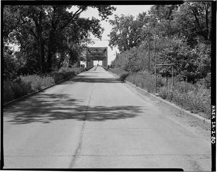
The Toll Bridge, officially the “Dubuque and Wisconsin Bridge,” was the original entrance from Wisconsin to Iowa, opened in 1902, and one of the Mississippi River’s last privately owned toll bridges. It’s hard to believe now, but if you drive down Eagle Point Road off 61/151 you would have come upon a narrow steel-grid-deck bridge with two sharp turns. The bridge was known also as the Eagle Point bridge because Eagle Point was on the Dubuque end. The name of the Wisconsin end, known then as “Kimball’s Slough,” apparently failed the marketing test.
The first time I saw the Toll Bridge, on a Boy Scout trip to New Mexico in 1979, I thought people should be paid to drive on it rather than charging tolls. My mother tells the story of her brother’s pointing out that you could see the Mississippi River if you looked down on the bridge deck, which made her complain to her mother that her brother was picking on her. For its first 35 years, the bridge was often closed when the Mississippi River flooded.
By 1960, according to old road maps I’ve seen, 151 was moved to what is now Business 151. The 61/151 route was moved along Wisconsin 35 and Illinois 35 in 1969 into East Dubuque and the Julien Dubuque Bridge, because of structural problems with the Toll Bridge. That lasted until 1982, when the Dubuque-to-Wisconsin Bridge, including four lanes of 61/151 from Sandy Hook to the bridge, opened, and the Toll Bridge was dismantled as a hazard to navigation.
(The Library of Congress has three old photos of the Toll Bridge, one from the Wisconsin side. Before the 1993 Mississippi River flood, I went to the old bridge approach for the first half of a before-and-after shot. There was a piece of the old “TOLL BRIDGE” sign that went across the top of the entrance lying on the ground. I wish I had gotten it, though I don’t know what I would have done with it, other than lug it along on three moves.)
The 61/151 four-lane extended north to Dickeyville in 1994. The four-lane 151 opened from Dodgeville to Mineral Point in 2002, from Mineral Point to Belmont in 2003, from Belmont to Lafayette County XX opened in 2004, and from XX to Dickeyville in 2005. The old — well, middle-aged — 151 is now Business 151.
Most drivers don’t think of four-lanes as scenic, but they can be. And 151 between Mineral Point and Dickeyville certainly is, with a big downhill run to cross the Pecatonica River, and curves between (and in some cases through) the hills between Platteville and Dickeyville, where sometimes you can drive with the morning valley fog. Those curves are reminiscent of the old, bad two-lane 151, but the new road is much safer.