LOWER WISCONSIN RIVER - The 35th anniversary observance of the formation of the Lower Wisconsin State Riverway Board in 2024 kicked off on a beautiful spring day in rural Spring Green.
About 25 people gathered at the Frank Lloyd Wright Visitor’s Center on Saturday, April 13, for an outing that would take them along with Welsh Hills Trail, and then on the new Phoebe Point Trail to a stunning overlook above the Wisconsin River.
A variety of activities along the river will commemorate the Riverway Board’s anniversary. This will culminate in an ‘Anniversary Bash,’ scheduled for the Wisconsin Riverside Resort on Sunday, Oct. 27. That event is expected to draw legislators who helped to craft the political bipartisan consensus that resulted in the protection of the river from the Prairie du Sac Dam to its confluence with the Mississippi River at Wyalusing.
“Spencer Black, one of the legislators key to the passage of the Riverway Law, will be there,” LWSRB Executive Director Mark Cupp told the group. “When we celebrated an earlier anniversary, he said that the Riverway Law was the last bipartisan environmental legislation in the State of Wisconsin.”
In addition to Black, other luminary attendees are expected to include former Wisconsin State Senator Dale Schultz, and former Governor Tommy Thompson.
“It’s been an honor and a privilege to do this work since I was 29,” Cupp observed. “And now, in recent years, as government funding for public land acquisitions continues to dwindle, it is of paramount importance to recognize the work of, and partner with,private organizations like the Frank Lloyd Wright Foundation, Taliesin Preservation Association (TPA), Driftless Area Land Conservancy (DALC), and the Nature Conservancy, who are doing such great things in the Riverway.”
Cupp said that the Lower Wisconsin State Riverway covers about 100,000 acres, of which half are public and half are private. He said the Wisconsin DNR manages many properties in the Riverway for various different habitats and multiple species. The LWSRB, by contrast he said, exists to protect the scenic beauty and natural character of the Riverway, making the law that chartered it very unique nationally.
Other field trip leaders were Frank Lloyd Wright Foundation’s Mike Degen and Taliesin Preservation Director Ryan Hewson; Gigi LaBudde, LWSRB president and environmental educator; and Barb Barzen with the DALC trail building initiative.
Welsh Hills
The Welsh Hills Trail launches from the Frank Lloyd Wright Visitor’s Center, just across the river from Peck’s Landing south of Spring Green. Wright was of Welsh ethnicity, and so the names of landmarks on the iconic farm where he lived and worked often take Welsh names. The name ‘Taliesin,’ is Welsh for ‘shining brow,’ and the three hills on the Welsh Trail also have names derived from that language.
The three hills on the east side of County C all have Welsh names, beginning with the word ‘Bryn,’ which is Welsh for ‘hill or mount.’ Those names indicate their size or place, ‘Mawr,’ meaning “big,” ‘Canol,’ meaning “center,” and ‘Bach,’ meaning “small.”
Hikers can choose from two trail options. One is paved and relatively flat, and one winds through the woods and has some small elevation changes. Visitors can choose which one is right for them or take one out and the other back. The trail is just over one mile,and connects the Frank Lloyd Wright Visitor Center to Unity Chapel, which was built in 1886. The same trail can be used to return to the Visitor Center, or a paved walking path adjacent to Highway 23 can be used for the return hike.
“Thirteen years ago, the Frank Lloyd Wright Foundation developed a ‘natural landscapes program,’” The Foundation’s Degen told the group. “The effort is meant to reflect the impact that the natural landscape had on Wright’s work and his organic architectural style.”
Taliesin Preservation Association (TPA) is a separate entity from the Foundation. TPA oversees public programming at Taliesin, and the Frank Lloyd Wright Visitor’s Center.
Degen explained that TPA was formed with two goals:
1. Ecological restoration on the 800-acre property, which includes a half-mile of frontage on the Wisconsin River, and;
2. Bringing people onto the landscape.
“We’ve made a lot of progress, and we are very happy to share the Welsh Hills Trail, which opened five years ago, with the public,” Degen said. “In developing the trail, we worked with designers from the Ice Age Trail effort. Today, we’ll observe the different management techniques we use to restore the landscape, including invasive species management, brush control and prescribed fire.”
Hewson explained Wright family’s relationship with the land had begun in 1867, when the large Welsh Jones family of farmers, teachers and ministers settled part of the Wisconsin River valley near Spring Green. Family members included a young woman named Anna Lloyd Jones. This teacher caught the eye of William Carey Wright, a preacher, and musician. William soon won her affection and they married. On June 8, 1867, in Richland Center, a small town 20 miles west of Spring Green, Anna gave birth to a son named Frank Lloyd Wright.
According to Hewson, Wright spent summers on the farm, helping his uncle James and reveling in the beauty of the natural world.
“During his summers in the valley, he learned to pay particular attention to the patterns and rhythms of nature,” Hewson said. “The lessons he gleaned from nature would find their way into his later work again and again.”
The name for the home Wright built, destroyed twice by fire, ‘Taliesin,’ means ‘shining brow,’ and reflected his view that structures should be built ‘of the land’ versus ‘on the land.’ The home was constructed on the ‘brow’ of the hill to reflect his organic concepts of architecture.
Hewson said the buildings on the property have been recognized as a National Historic Landmark, and in 2019 the eight Frank Lloyd Wright sites were added to the United Nations Educational, Scientific, and Cultural Organization (UNESCO) World Heritage List. UNESCO recognizes landmarks or sites for having cultural, historical, or scientific relevance throughout the world.
While walking the Welsh Hills Trail, field trip participants divided into two groups – those who took the ambitious climb to an upper restoration area, and those who rambled peacefully along a relatively flat trail crossing the middle of the hills. Hikers observed restoration of goat prairies on hillsides that had become choked with red cedar, heard about use of prescribed fire, and observed spring ephemeral plants and birds.
“This hillside was covered in red cedar 10 years ago,” LaBudde told walkers on the lower trail. “Because of the absence of fire on the landscape, native species seen in a goat prairie environment were suppressed by fast growing species like red cedar shading them out.”
Hewson detailed that the work had begun with cutting out some of the larger hardwoods growing on the slope. This, he said, changed the light regime, and let the flora in the understory begin to rejuvenate. At that point, TPA began to use prescribed fire to restore the native communities.
“We’ve been working for the last 20 years using a Department of Transportation map from 1955 that shows what the land looked like then,” Hewson said. “The goal is to restore the land to what it looked like in 1959 – the year of Frank Lloyd Wright’s death.”
Phoebe Point Trail
The Phoebe Point Trail is the newest section of the ambitious ‘Driftless Trail’ being developed by Driftless Area Land Conservancy. The trail runs on a 40-acre parcel of Frank Lloyd Wright Foundation lands to the north of the property, where Taliesin is located. Work is currently ongoing on 7-8 acres of that parcel.
“We started at the top, and are working our way down,” Degen explained to the group. “In Frank Lloyd Wright’s time, this parcel would have been grazed, and that has resulted in a very degraded woodlands environment that promotes growth of invasive species.”
Degen told the group they are managing for better tree species, especially Burr Oaks and oak regeneration in general. He said that early succession, quick growing species move in very fast after a woodlands is cleared, and so constant vigilance is required.
Barb Barzen said that Driftless Area Land Ccnservancy had been fortunate to partner with a designer for the North Country Trail that had retired near Dodgeville in trail design. She said that DALC had worked with WisCorps employees initially to establish the base of the trail, and has worked with volunteers to improve it ever since.
When hikers reach the top of the lands undergoing restoration, they are treated to a stunning view overlooking the confluence of Lowery Creek with the Wisconsin River.
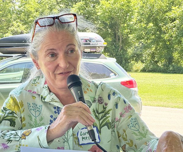
“Six years ago, DALC began working with the National Parks Service to implement our vision of a 50-mile trail connecting three state parks – Tower Hill, Governor Dodge, and Blue Mounds,” DALC Community Conservation Specialist Barb Barzen told the group. “The trail is meant to be primarily a quiet trail experience, but some segments of it will be shared use.”
Barzen said that because there has been little investment in acquisition of public lands in recent years, the trail effort is dependent on cooperation with private landowners. She pointed out that in northern Wisconsin counties, as much as 30% of the land is publicly owned, whereas in the southern part of the state, public ownership averages out to about three percent open for outdoor recreation.
“In the Lowery Creek area, we have found many willing landowners who believe in the idea of public access to lands, and the stars are aligning,” Barzen said. “The first segment of the trail opened was the Weaver Road loop, and in December of 2023, we launched the Phoebe Point Trail.”
The Weaver Road Trail is a 1.1-mile ‘lollipop loop,’ located just north of Governor Dodge State Park. The first portion of the trail offers a spectacular view - and is exposed to strong winds when they occur. The trail is great for hiking in light snow and snowshoeing in deeper snow, but is not good for cross-country skiing.
“The new Phoebe Point Trail is a 1.1-mile-long ‘lollipop loop,’ part out-and-back, with a loop in the middle,” Barzen explained. “It offers stunning views up and down the Wisconsin River, across the Taliesin property, and across much of the Lowery Creek watershed. This segment of the Driftless Trail is a collaboration between the Driftless Area Land Conservancy, Frank Lloyd Wright Foundation, and Taliesin Preservation.”
The Welsh Hills Trail has also been added to the Driftless Trail portfolio of outdoor experiences. The segment on the ridgetop will be a 2025 collaboration between DALC and TPA. Another trail in the mix is the Knobs Road Trail, which offers a lot of variety as it traverses oak woods, pastures, hayfields, an orchard, and a Mill Creek tributary. It includes 2.7 miles on a farm that produces grass-fed beef, plus a 1.1-mile stretch of Knobs Road to return to the trailhead. For a nice two-mile out-and-back hike, go to the top of the ridge to enjoy a 360-degree vista before turning around.
More information, and trail maps, can be found at:
www.driftlessconservancy.org/driftless-trail
“We rely on volunteers for trail building,” Barzen told the group. “We have monthly work days, and I’ve discovered that it can be a lot of fun, and also very fulfilling.”
Barzen said that some have asked why a land conservancy like DALC is leading the creation of the Driftless Trail.
“At DALC, we see land conservation as being about more than just acquiring conservation easements,” Barzen explained. “In order to achieve conservation on a landscape scale, we have to involve the community. For this reason, we see trail development as a crucial conservation strategy.”
Barzen said that DALC is working on an interpretive project for the trail, adding signs that portray the natural and cultural heritage of the land the trail is built through. She said that the goal is to bring intentionality into the landscape that we live in.