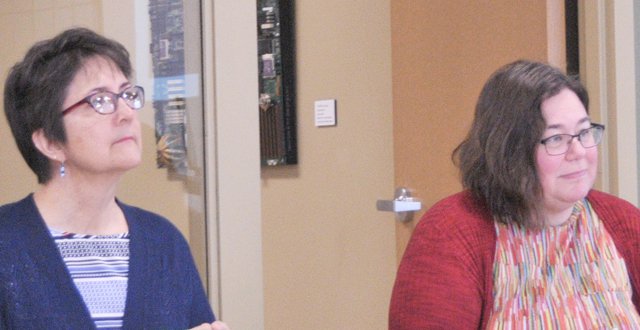
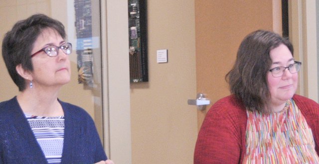
CRAWFORD COUNTY - Two Department of Agriculture, Trade, and Consumer Protection (DATCP) staff spoke to members of Crawford County’s CAFO Study Group on Thursday, March 12.
DATCP’s Jennifer Heaton-Amhrein and Lisa Trumble told group members that their best approach to protect water in the county through ordinances regulating agriculture is to cite local “scientifically defensible findings of fact.”
Standards more stringent than those dictated by statewide DATCP or DNR rules can be implemented if:
• adopted in ordinance
• based on scientifically defensible findings of fact
• justified by public health and safety
If the more strict local standards relate to water quality, then they will have to be reviewed by WDNR or DATCP. If the more strict standards relate to other matters regulated or not regulated by the statewide livestock facility siting law, there is no state review process. Matters such as restricting the method and amount of transport or land spreading of manure could be brought on appeal to the DATCP Livestock Facility Siting Review Board or be reviewed in a court action brought by an entity that decided to challenge them.
Local facts
By later in 2020, Crawford County is expected to have two relevant data sets which will provide local, scientifically defensible findings of fact: soil maps developed by the Wisconsin Geological and Natural History Survey (WGNHS); and the results of the Driftless Area Water Study (DAWS).
Crawford Stewardship Project (CSP) has also completed mapping of sinkholes in the county, and monitors surface water quality regularly as well.
CSP’s ‘Karst Landscapes and Groundwater Susceptibility Survey’ findings indicate there are 264 “probable” and 195 “possible” sinkholes—that’s a total of as many as 459 sinkholes in Crawford County.
This qualifies Crawford County as a ‘high sinkhole density area’ (over 25 sinkholes/sq.km., according to the only large scale study done comparing various karst regions of the US).
Surface water quality monitoring results from 2019 have revealed amounts of E.coli, a dangerous coliform bacteria, in streams in the county.
E.coli readings in the surface waters of Boydtown and Richland Creeks in Crawford County were measured by Crawford Stewardship Project (CSP) in the month of October 2018, at 82,000 and 19,000 colony forming units respectively.
“To put that in perspective, the average E.coli reading for a body of surface water should not be over 126 colony forming units,” Forest Jahnke of the Crawford Stewardship Project told members of the Crawford County Land and Water Conservation Committee on Tuesday, Nov. 13. “E.coli readings in bodies of surface water should never go above 410 colony forming units more than 10 percent of the time, and in other parts of the state, if a reading reaches 750 they’ll issue an advisory, and if it goes above 1,000, measures such as closing of beaches are implemented.”
DAWS is a well water testing study taking place in Crawford, Richland and Vernon counties. The study will be similar to the phase one testing undertaken in the Southwest Wisconsin Groundwater and Geology study (SWIGG) in neighboring Grant, Iowa and Lafayette counties. Like SWIGG phase one, DAWS will test well water in the three counties for nitrate and coliform bacteria. It is unknown what the DAWS study will reveal about well water quality in the three counties.
Crawford Stewardship Project and the Tainter Creek Watershed Council have already completed well water testing in some wells in Crawford County. The wells tested in those two studies were mainly in the northern part of the county.
Nitrate results to date
Kevin Masarik, groundwater specialist and executive director of the UW-Extension Center for Watershed Science and Education (CWSE), provided a report on a well water sampling initiative undertaken by Crawford Stewardship Project in March of 2019. The groundwater specialist reported that 66 percent of wells sampled showed nitrate results of less than two milligrams per liter (mg/L), which is the naturally occurring level of nitrate in groundwater throughout the state. Four percent of the sampled wells showed results above the 10 mg/L federal safe drinking water standard.
The Tainter Creek Watershed Council has now completed two rounds of well water sampling in November of 2018 and 2019. The wells sampled are in Crawford County’s Utica Township and Vernon County’s Franklin Township.
In the Tainter Creek Wa-tershed in 2018, 44 wells were sampled – 26 in Vernon County and 18 in Crawford County. In 2019 39 samples were taken – 21 in Vernon and 18 in Craw-ford. Of the total 39 wells sampled in 2019, 10 were repeats from 2018, and 29 were wells not tested in 2018.
The combined November 2018 and 2019 results showed seven wells with no nitrate at all (eight percent), and 17 wells with nitrate levels at two mg/L or less (20 percent). There were 14 wells that showed nitrate levels between two and five mg/L (17 percent), and 28 wells with nitrate levels between 5-10 mg/L (34 percent). A total of 17 wells showed a nitrate level of greater than 10 mg/L (20 percent, and no wells showed a nitrate level of greater than 20 mg/L.
Coliform results to date
In the March 2019 testing of wells in Crawford County led by Crawford Stewardship Project, 8 of the 53 samples tested positive for the presence of coliform bacteria (15 percent). Of the 8 samples that tested positive for coliform bacteria, there was one sample that also tested positive for E.coli.
In the November 2019 testing of wells in the Tainter Creek Watershed, 14 of the 39 samples tested positive for the presence of coliform bacteria (36 percent). Of the 14 samples that tested positive for coliform bacteria, there were no samples that tested positive for E.coli.
In the November 2018 and 2019 testings combined, 25 of the 83 wells sampled tested positive for coliform bacteria (30 percent). Of the 25 wells that tested positive for coliform bacteria, no wells tested positive for E.coli.
County soil maps
Dr. Eric Carson with WGNHS is the point-person on developing soil maps for counties in the Driftless Area of Wisconsin. In 2019, his team completed mapping of Crawford, Vernon, and Richland counties. Those maps are currently undergoing peer review, and will be released in middle-to-late 2020 after that process is complete.
Wisconsin State Geologist Ken Bradbury, who spoke recently in Platteville about the movement of contaminants in ground water, stated that these maps “will show depth of soil to bedrock.” He said the maps will also reveal more about a layer of clay, the Rountree Formation, which is present in some places in the Driftless. Some have theorized that this layer may be protective of groundwater aquifers located in the bedrock beneath.
Carson reported recently that the work on Monroe County is a little over half done, but with how priorities for mapping have evolved it looks like it will be summer of 2022 before Monroe County is complete. His team will have Grant County maps complete by summer 2020; Iowa County by summer 2021; and Lafayette County by summer 2022 or 2023.
Sensitive areas
NR 151 is the DNR rule in Wisconsin that regulates runoff management. Consistent with state statutes, NR 151 directs the DNR to promulgate rule performance standards to meet water quality standards and address specific issues either geographically or by activity.
In the winter of 2018, the Wisconsin Natural Resources Board voted to send ‘sensitive area’ revisions to NR 151 to the governor, and then the legislature, for approval. The legislature approved the rule revision sent to them by Governor Scott Walker in summer of 2018 for 15 counties in eastern Wisconsin.
The process had begun in 2016 after homes in Kewaunee County began to experience brown tap water events, and tests revealed high nitrate and coliform bacteria contamination of well water.
The NR 151 rule modification is to develop a targeted performance standard to address land spreading of manure on soils in sensitive areas of the state — i.e. where depth to bedrock is shallow and the bedrock is fractured (also described as karst topography).
Town of York
The Town of York in Green County has taken the step of making changes to their ordinance regulating livestock facility siting and manure spreading based on local scientifically defensible findings of fact. Their more strict local standards relate to manure application setbacks for wells; prohibits manure spreading in areas with less than two feet of soil over fractured karst bedrock; imposes limitations on transport of liquid manure; requires use of latest rainfall data in design of manure storage pits; and requires a nine month storage capacity for liquid manure.
The town’s local adopted findings include:
• Environmental Health and Safety Risk to Water Quality, Air, Soil Quality and Natural Areas from CAFOsstudy prepared for the neighboring Town of Sylvester (which included a comprehensive literature review and recommendations for actions)
• Findings related to Water Testing in the Town
Kewaunee study
The study of water quality in Kewaunee County was the blueprint for both the SWIGG and DAWS water quality studies. Like the Kewaunee study, both SWIGG and DAWS have conducted or will conduct basic well water quality surveys documenting any unsafe levels of nitrate and/or coliform bacteria in well water. Both studies will also include a ‘phase three’ correlational analysis of risk factors that can lead to greater risk for well water contamination.
The Wisconsin Center for Investigative Journalism published a story describing the correlational risk factor analysis results from the study in Kewaunee County led by USDA microbiologist Mark Borchardt. The article, ‘Most nitrate, coliform in Kewaunee County wells tied to animal waste,’ detailed that the study found the number one risk factor for contamination was the proximity of a well to a manure storage pit.
Borchardt said the closest well in the study was 150 feet from a manure pit, but even wells three miles away still have some risk of being contaminated with coliform.”
Among Borchardt’s find-ings were:
• septic systems were not linked with coliform and nitrate contamination, sug-gesting the sources are agri-cultural.
• coliform bacteria con-tamination is linked with how close a well is to a manure lagoon.
• high nitrate contamina-tion (greater than the health limit of 10 parts per million) is linked to presence of agricultural fields around a well, distance to the nearest agricultural field, distance to nearest manure lagoon and depth to bedrock.
• the higher the number of septic system drain fields around a well, the greater the probability of the well becoming contaminated with human waste.


