CRAWFORD COUNTY - A ‘Karst Geology Tour,’ held Saturday, August 15, attracted almost 40 participants on a beautiful summer day. Participants came from Crawford, Vernon, Richland, and even LaCrosse counties. Brad Pfaff, Democratic candidate for Wisconsin’s 32ndState Senate District was present to take in the educational opportunity.

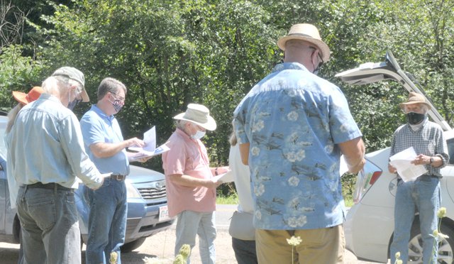
The event, organized by the Crawford Stewardship Project, took participants on a tour of four geologically significant locations in Marietta Township. Speakers provided education about karst geology and how it makes groundwater aquifers more vulnerable.


The first stop on the tour was the Kramer Quarry on County E, where participants heard Dr. Kelvin Rodolfo discuss the geological layers characteristic of the Driftless Region. The quarry’s towering rock walls provided participants with a visual understanding of the layered and fractured nature of a karstic bedrock geology.
Rodolfo explained that near the top of the “stack” of geologic layers in the Driftless Region are layers of dolomite, a type of rock composted of calcium and magnesium carbonate. These layers are interspersed with layers of sandstone, which form the aquifers in southwest Wisconsin.

The dolomite layers – Platteville/Galena, and Prairie du Chien - are very susceptible to dissolution from carbonic acid over geologic time. Carbonic acid is formed when water from the surface, such as rain water, combines with carbon dioxide from the air. These layers become cracked and fissured, and allow water from the surface to travel quickly down into the deeper sandstone layers which house the aquifers.
Once the water reaches the aquifers in the sandstone layers, it fills in the spaces in the rock between the rounded quartz crystals that make up the sandstone. In this location, water moves much more slowly. This means that when contaminants from the surface penetrate to these levels in the bedrock geology, they will stay there for a very long time.


The second stop on the tour was a cliffside seep on the property of Dave and Sandy Collins. This heavily forested spot demonstrated the manner in which the ground and surface water systems are integrally connected in a karstic system. Water from the aquifers can emerge onto the surface through seeps, springs, and underground rivers that begin at some point to flow on the surface.
Shimpach Cave
Perhaps the most eye-opening part of the tour was a visit to the land of John Shimpach, which contains a cave large enough to stand up in. Shimpach’s property where the cave is located is just off Harvest Lane in Marietta Township, about a half mile from the proposed location for Roth Feeder Pigs II.
“The cave was likely formed when softer layers of rock below dissolved and collapsed,” Rodolfo explained. “The harder layers above and below which form the ceiling and floor of the cave are less vulnerable to dissolution, and so you get a cave.”

In order to access the cave, participants had to climb up a forested hillside until they reached the mouth of the cave. Then, they had to descend into the open mouth of the cave using a rope anchored to a tree. Once inside the cave, rocks distributed throughout the area formed a nice seating area.


Buried sand dunes
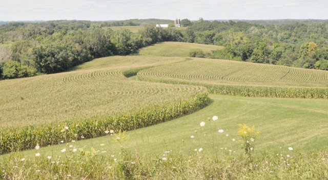
The last stop on the tour was at the Marietta Township property of Jeff and Susan Robinson. The Robinsons are grassfed beef farmers, and their property is an open vista of green grasslands, dotted with farm ponds, providing habitat to grassland bird species.

Along the side of the farm road, participants gathered to look at a unique rock formation. Dr. Rodolfo explained that he wanted the tour participants to see these rocks in order to form a better appreciation for the rocks in which southwest Wisconsin’s aquifers are located.


“What you see before you that looks like layers of rock is really buried sand dunes,” Rodolfo explained. “The unique sandstone in our region, formed of rounded quartz crystals, makes our aquifers some of the cleanest and most abundant on the planet.”
Rodolfo explained that the rounded grains of sand were formed by wind erosion over the course of millennia. The grains of quartz, which form the sandstone, became rounded, according to Rodolfo, when they bumped into each while being blown and deposited on the landscape.