
CASHTON - Monroe County Conservationist Bob Micheel announced at a meeting concerning the future of the breached dams in the Coon Creek watershed that a study would likely take place in the Coon Creek and West Fork Kickapoo-Vernon County watersheds.
The study as proposed will initially be 100-percent funded by the USDA NRCS (United States Department of Agriculture Natural Resource Conservation Service) If approved, the watershed study will start in 2019 and last approximately two years.
“It is looking like this study will be approved, but no commitments have been made yet,” said USDA NRCS Assistant State Conservation Engineer Scott Mueller. “I’m still working on the cleaning-up-the-mess part of what was presented at the Vernon County LCD (Land Conservation Department) meeting right now.”
Micheel told the almost 50 citizens present for the meeting at the Cashton Fire Department on Thursday, Feb. 7, that the study would be undertaken for the purpose of evaluating the two watersheds and their flood control dams in light of changes in recent years in rain events and land use. The study will assess the impact of runoff and flooding, which place stress on the flood control structures in the area.
Mueller confirmed, that if approved, the study would take into account changes in frequency, volume and intensity of the rain events the area has increasingly seen.
“Changes in rainfall will be included in the study,” Mueller said. “The dams will be evaluated using the current rainfalls officially adopted by Wisconsin NRCS. The latest hydrology methods and amounts will be used. Changes in land use will also be taken into account.”
Micheel passed around a copy of a watershed study for Coon Creek that had been undertaken by the Soil Conservation Service (SCS) in 1934. SCS was the federal agency within the USDA, which was the predecessor to NRCS. This was the era when Coon Creek became the location of the nation’s first watershed project, and transformed methods of soil conservation in the U.S. and around the world. Indeed, that history is one of the reasons that today’s NRCS is contemplating a new watershed study.
“The folks who built the dams in the 1950s never envisioned the kinds of rain events we’re seeing in recent years or that the dams would overtop,” Micheel said. “What happened to the dams in Vernon and Monroe County in August of 2018 has not happened anywhere else in the nation where similar dams are in place, and that is why there is so much interest in studying the two watersheds.”
Lots of changes
Micheel explained that a lot has changed since the dams were built in the late 50s and early 60s.
“Back in the 50s and 60s, 60 percent of the land in the Coon Creek watershed was enrolled in conservation programs,” Micheel explained. “That’s not happening anymore. We see removal of the old contour strip plantings, and the amount of land in pasture has decreased from 50 percent to 10 percent.”
Micheel went on to explain that one of the things that is producing healthier trout streams, but contributing to flooding problems is an increase in the base flow of the springs, which feed the two watersheds.
“With an increase in lands in forest and getting the cattle out of the woods, we are seeing improved water infiltration into the ground,” Micheel said. “This is making the base flow of the springs in the watersheds flow higher, and the pipes in the dams are pressed to keep up with the increased flow.”
Another significant factor leading to increased runoff, according to Micheel is the increase in ‘impervious’ surfaces in the watersheds. Impervious means that the surface does not allow water to be absorbed into the soil, which means that they produce 100 percent runoff. Examples of impervious surfaces include roofs of buildings, driveways, roads and parking lots.
But the bottom line, according to Micheel, is that in recent years the rainfall events have become more frequent, and more intense in shorter periods of time.
“In Southwest Wisconsin the average rainfall is 33 inches per year,” Micheel explained. “In 2018, between April 3 and December 31 of 2018, Southwest Wisconsin received 60.79 inches of rain.”
Micheel said “we can’t design for that much rain within our budgets. Farmers can’t put up hay with that much rain since we are seeing fewer dry, sunny spells.”
Monroe County is home to the headwaters of four watersheds: Kickapoo River, Baraboo River, Lemonweir River and Coon Creek.
Climate change a factor
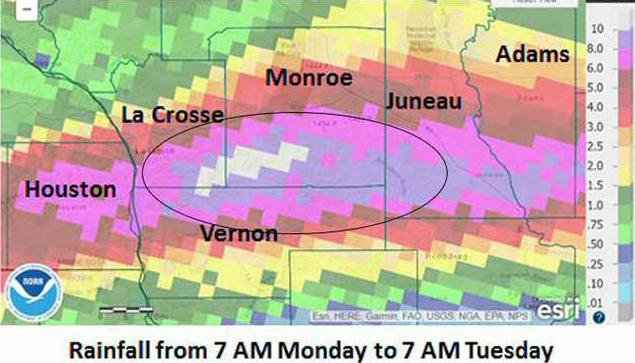
“The fact is that our area is increasingly experiencing the impacts of climate change in the form of increased volume and intensity of rainfall,” Micheel said. “Since 2007, our area has seen 16 major flooding events, and the average temperature has increased 1.5 to 2 degrees. The rainfall that caused the dams to breach in the overnight hours of Monday, Aug. 27 into Tuesday, Aug. 28 came in the form of 13 inches in about six hours – that’s over two inches of rain per hour for six hours straight.”
Micheel explained that since 2007, the area has seen a few storms that are classified as “700 to 1,000-year storms.”
“The FEMA floodplain maps are all based on the 100-year storm, and that is the specification that the flood control dams were designed for as well,” Micheel said. “All of our conservation work design is based on a 10-year flood model, for instance our smaller flood control structures built in the uplands of the watersheds. We can’t afford to design flood control structures to a 1,000-year flood level.”
Micheel told meeting participants that “we have to get away from the notion of flood control. The idea that we can control nature, I believe, is an arrogant notion.”
Micheel says the path of the future will be to design for “management of precipitation impact” and “management of flood risk.”
“We have to be proactive, not just reactive,” Micheel said. “We can’t just put the dams back the way they were before the August 2018 flood. We need to think about where people are living and building structures, and we need to do land use planning to protect property values and public safety, and to mitigate flooding.”
Future of the dams
Both Bob Micheel and Vernon County PL-566 Dams Manager Mark Erickson confirmed that the process to determine the future of the breached dams will be a two-to-ten-year process.
In 2019, the dams that were damaged but not breached will be repaired using a combination of NRCS Emergency Watershed Protection (EWP) funds and county funds, Micheel and Erickson explained. With the breached dams, we will stabilize them by reshaping the channel where it comes around the dam into the pool area, using shaping and riprap, to ensure that the structures don’t further erode – a process referred to as ‘head cutting.’
Micheel and Erickson both confirmed that the dams that breached would remain wide open until the proposed study is completed.
“We are not going to just put the breached dams back the way they were before the flood,” Micheel said. “The problem isn’t the clay dams themselves, but rather the fractured sandstone in the hillsides to which they are anchored. This is particularly true of the dams that are placed lower down in the watershed where the layer of soil over the sandstone is thinner. The dams higher up in the watersheds that were anchored to a thicker layer of clay survived.”
Micheel said that if the results of the study indicate that the dams should be left in the same location, they would be constructed differently.
“Right now, the top of the dams are sloped to channel water over to the hillside where the dam is anchored and where the emergency spillway is located,” Micheel said. “If they are rebuilt in place, they will be sloped to channel water to the middle of the dam, and likely the number of emergency spillways will be increased. We are also going to take a hard look at who and what is in harms way below the dams in their hydraulic shadow.”
Monroe County Sanitation and Zoning Manager Allison Elliott explained that the FEMA maps of the floodplain would eventually be updated to redefine the ‘100-year-flood’ standard from the current ‘six inches in a 24-hour period’ to ‘seven inches in a 24-hour period.’
“All of the breached dams, based on who lives in and what structures exist in the hydraulic shadow, have previously been classified as ‘low hazard’ structures,’ Elliott explained. “Now those structures will have to be reclassified as ‘high hazard structures,’ and this will change the insurance picture both for the dams and for homes and structures below the dams.”
At the mercy of nature
Town of Portland Board Chairman Gary Flock seemed particularly concerned that the dams would be left wide open for the duration of the proposed study. His particular concern was about evaluating town roads and bridges adequacy to withstand flooding events if the dams are not in place and functioning.
“With the dams in place, townships only need to worry about the amount of water being released out of the emergency spillway pipe,” Micheel said. “Without the dams, they have to think about the water coming off the entire watershed drainage area. I’ve told Gary that in thinking about his bridges and roads, he needs to just pretend like the dams are not there.”
The reality is that without the dams, the cost of infrastructure improvements adequate to handle the volume of runoff from the watershed basin will be increasingly expensive.
Micheel reported that his department would be hiring a land use planner in 2019. This employee, according to Micheel, was approved by the county board, and will work with towns and municipalities, and will be very active in writing grant proposals.
“You’ve told us what will happen in 2019 with the breached dams,” citizen-participant Charles Arndt said. “But you haven’t told us what will happen in 2020 and beyond.”
Micheel responded that that is where the study will come in.
“It’s going to require all hands on deck, with the affected citizens in LaCrosse, Monroe and Vernon counties coming together with the professionals from the agencies,” Micheel said. “We have to take the time and care to look at the big picture, at what we’re doing on the landscape, what impacts climate change is having, before we can decide what to do about the breached dams.”
Tucker Gretebek is the landowner, who owns land just below the Luckasson Dam that breached and sent a tsunami of water down into Rulland Coulee and ultimately into Coon Valley and Chaseburg. His family’s pumpkin patch, building and farm equipment were swept away in the devastation.
“We all need to be proactive in keeping this issue in the forefront of the minds of our elected state and federal representatives,” Gretebek said. “If we don’t speak up for ourselves, then the issue will fade away into the background.”
Wisconsin State Assembly Representative Loren Oldenburg attended the meeting as well.
“I haven’t been able to meet with Governor Evers yet about this issue, but I have met several times with State Senator Jennifer Shilling, and she is in communication with the Governor about our issues with the dams,” Oldenburg said. “It’s just a matter of determining when the time is right to ask for funding, and to know how much funding to ask for.”
Mark Erickson explained that Vernon County had made the decision back in 2009 to “separate from the federal government” when repairing Jersey Valley Dam because the cost of the upgrade recommended by the federal agencies was prohibitive.
“What we found out is that when we separate from the federal government, then we’re all alone,” Erickson said. “If we keep our federal ties, then there is shared responsibility.”
Erickson said that “all options are on the table” with Jersey Valley and Mlsna Dams, the two dams in Vernon County that breached in August 2018.
“We don’t know what is going to happen to Jersey Valley Dam, but the hiking trails will be open in the spring,” Erickson said. “No matter what, it will continue to be a county park, but we don’t know if it will have a lake or be improved for trout fishing, or what.”
Next meeting
Bob Micheel explained that the Vernon and Monroe County Land Conservation Departments are both in possession of the ‘Trip Report,’ from when NRCS teams from Oklahoma and Stillwater, Minnesota, visited the site of the breached dams in September 2018.
“We are expecting another report, the ‘Failure Report,’ in February, and from there we’ll work on getting the watershed study up and running, Micheel said. “After that, probably in March or April, we’ll call another meeting and start to provide details about what the citizen’s role in the study will be.”


