
The Wisconsin Department of Natural Resources submitted the updated list of impaired waters to the United States Environmental Protection Agency (EPA) on April 1, a process repeated every two years.
Only ten Wisconsin groundwater bodies were recommended for removal from the list - - four inland beaches, two lakes from the Sugar Camp chain in Oneida County, and 16 miles of sections from three streams.
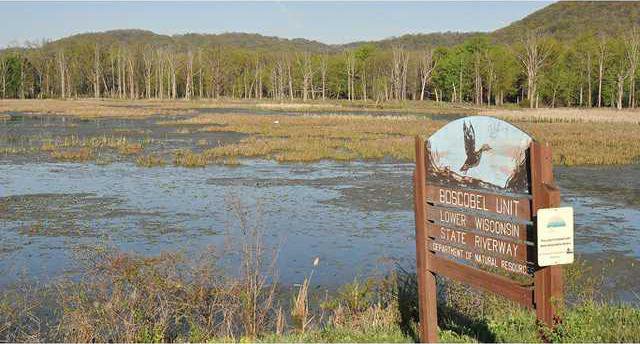
Numerous groundwater bodies – creeks, streams, rivers, and lakes – within the area exist on the list. The state is required through the Clean Water Act to provide this information to the federal government.
The EPA requires the state to also create a plan to address restoration of water quality within eight to 13 years for those water bodies on the list, according to Aaron Larson, a natural resources financial assistance specialist with the Wisconsin Department of Natural Resources. To do so, the state analyzes the pollutants in a groundwater body, determines a restoration plan for reducing pollutants, and implements the plan.
“The state determines the priority of the water body, and obviously, if that is high, it will be done first, generally within two years,” Larson said. “Once the high priority waters are addressed, then we move on to the medium priority and down the list.”
The EPA offers guidance, but does not specify the course of action or timeline.
On the fully impaired and proposed lists are:
Note: Total Maximum Daily Load (TMDL) describes the maximum amount of a pollutant that a body of water can receive while still meeting water quality standards.
Grant County streams
• Bacon Branch – miles 0 to 6 – fully impaired due to degraded habitat – TMDL needed, low priority;
• Big Patch Creek – miles 0 to 5 – fully impaired due to sediment levels degrading habitat;
• Blake Fork – miles 0 to 17 – fully degraded due to phosphorus levels resulting in water quality use restrictions and an unknown pollutant degrading the biological community – TMDL needed, low/medium priority;
• Blue River – miles 0 to 18 – fully impaired due to phosphorus levels – TMDL needed, low priority;
• Boice Creek – miles 0 to 16 – fully impaired due to an unknown pollutant degrading the biological community – TMDL needed, low priority;
• Bull Branch – miles 0 to 2 – fully impaired due to phosphorus levels – TMDL needed, low priority;
• Chase Creek – mile 0 to 1 – fully impaired due to sediment levels degrading habitat – TMDL needed, low priority;
• Culver Branch – mile 0 to 2 – fully impaired due to sediment levels degrading habitat – TMDL needed, low priority;
• Doc Smith Branch – mile 0 to 3 – fully impaired due to phosphorus levels;
• Fennimore Branch (Castle Rock) – miles 17 to 26 – fully impaired due to sediment levels degrading habitat and phosphorus levels;
• Grant River – miles 0 to 26 – fully impaired due to phosphorus levels;
• Gunderson Valley Creek – miles 0 to 5 – fully impaired die to sediment levels degrading habitat and phosphorus levels;
• Kuenster Creek – miles 0 to 10 – fully impaired due to an unknown pollutant degrading the biological community and sediment levels degrading habitat – TMDL needed, low priority;
• Little Platte River – miles 0 to 34 – fully impaired due to phosphorus levels degrading the biological community – TMDL needed, medium priority;
• Louisburg Creek – miles 0 to 5 – fully impaired due to sediment levels degrading habitat – TMDL needed, medium priority;
• Marlowe Branch – miles 0 to 6 – fully impaired due to an unknown pollutant that is degrading habitat – TMDL needed, low priority;
• Martin Branch – miles 0 to 10 – fully impaired due to sediment levels degrading habitat;
• Martinville Creek – miles 0 to 5 – fully impaired due to unknown pollutants elevating water temperature, sediment levels degrading habitat, and phosphorus levels degrading the biological community – TMDL needed for phosphorus and unknown pollutant, low priority;
• Muskellunge Creek – miles 0 to 5 – fully impaired due to phosphorus levels resulting in water quality use restrictions and an unknown pollutant degrading the biological community – TMDL needed, low/medium priority;
• Pidgeon Creek – miles 0 to 14 – fully impaired due to phosphorus levels resulting in water quality use restrictions and an unknown pollutant degrading the biological community – TMDL needed, low priority;
• Platte River – miles 0 to 38 – fully impaired due to phosphorus levels – TMDL needed, low priority;
• Rattlesnake Creek – miles 0 to 21 – fully impaired due to an unknown pollutant degrading the biological community – TMDL needed, low priority;
• Rogers Branch – miles 0 to 12 – fully impaired due to sediment, an unknown pollutant, and phosphorus levels resulting in low dissolved oxygen, degraded habitat, and degraded biological communities;
• Sandy Creek – miles 0 to 6 – fully impaired due to sediment levels degrading habitat – TMDL needed, low priority;
• Sinsinawa River – miles 0 to 10 – fully impaired due to phosphorus levels degrading the biological community – TMDL needed, medium priority; and
• Young Branch – fully impaired due to phosphorus levels – TMDL needed, medium priority
Wisconsin River – contaminated fish tissue from E. Coli, Mercury, PCBs, Dioxin; phosphorus levels resulting in both eutrophication (a high concentration of nutrients that can cause algal bloom, disrupt ecosystems, etc.) and low dissolved oxygen (miles 159-173 in Adams and Juneau Counties); and unknown pollutants resulting in chronic aquatic toxicity (miles 289-294 at Lincoln) – TMDL needed, low priority;
Mississippi River – fully impaired due to phosphorus levels, PCBs, Mercury – TMDL needed, low priority
Prior to submitting the list to the EPA, the DNR held a public informational webinar on November 3, 2015 and a formal public comment period from October 27 to November 25, 2015. A small number of changes were made to the list based on public input.
Comments received during the public notice period and DNR responses, indicating any changes to the draft 2016 impaired waters list, and an updated impaired waters list were submitted to the EPA for their review. The EPA will review the list according to the requirements of Section 303(d) of the federal Clean Water Act. When the EPA makes an approval decision on the submitted list, the DNR will announce the final 2016 list via GovDelivery message and posting on their website.
Information on the state of Wisconsin’s waters can be accessed on the DNR Wisconsin Water Quality Report to Congress 2016 website.
A searchable database of impaired waters, both listed and proposed is available online at http://dnr.wi.gov/water/impairedSearch.aspx.
More information about the listing process can be found on DNR’s impaired waters webpage at http://dnr.wi.gov/topic/impairedwaters. For questions, please contact Aaron Larson at 608-267-9385 or at DNRImpairedWaters@wisconsin.gov.


