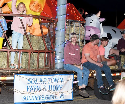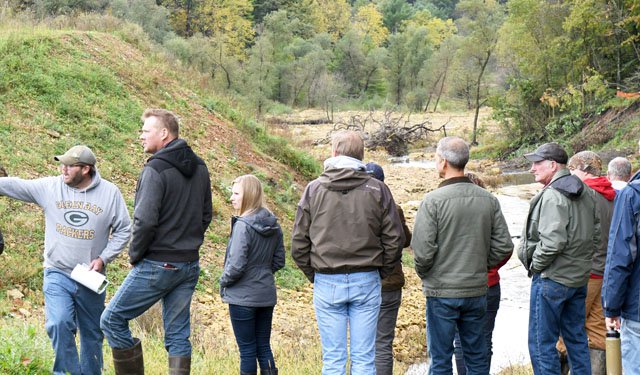
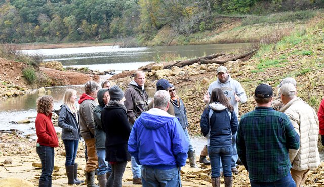
VERNON COUNTY - The Vernon County Land Conservation Department hosted a statewide group of conservation technicians on Thursday, Oct. 3. The ‘Fall Tech Tour’ drew almost 40 participants, with the technician from Ashland County having traveled the furthest.
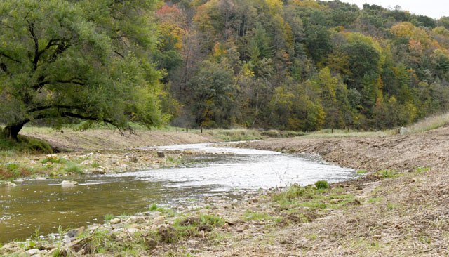
On the agenda for the day was viewing the Jersey Valley Dam which breached in August of 2018, and inspecting a streambank restoration project along the West Fork Kickapoo River just below the breached dam. Later the technicians heard a presentation about farmer-led watershed councils from the Tainter Creek Watershed Council. Finally the group took a trip to the Duck Egg Dam to see the goat herd the county uses for invasive species removal.
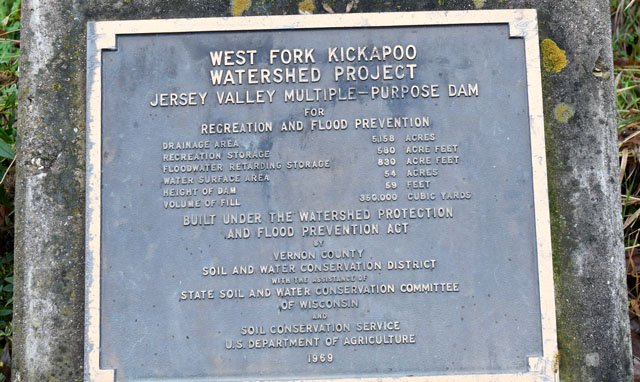
Jersey Valley Dam
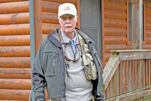
Vernon County PL-566 Dam’s Manager Mark Erickson spoke to the group about the county’s 22 PL-566 flood control structures before the group boarded a bus to visit the Jersey Valley Dam.
Erickson explained that Vernon County is home to 25 percent of the PL-566 flood control structures in the State of Wisconsin. The Mlsna and Klinkner Dams in the West Fork Kickapoo headwaters were the first two PL-566 dams built in Vernon County. They are referred to, to this day, as the ‘pilots.’
The two dams were completed in 1956, and Mlsna was one of the two dams in Vernon County that breached in August 2018, according to Erickson. The Duck Egg Dam on the North Fork Bad Axe River was the last PL-566 dam to be built in the county, completed in 1987. In total there are eight dams in the Bad Axe River Watershed, and nine in the West Fork Kickapoo Watershed. In the Coon Creek Watershed there are dams in Vernon, Monroe and LaCrosse counties – five in Vernon, seven in Monroe and two in LaCrosse.
The Jersey Valley Dam was completed in 1969, at a cost of $340,000, which in 2019 dollars would be $2,378,708.
In 2005, the county was ordered by the DNR to draw down the dam because of a manure-laden downstream seep that was discovered from the dam. This seep was coming through the fractured sandstone layer of the abutment, and constituted a clue that the seep was in fact connected to the impoundment of water (the lake) behind the dam where the manure had collected. The draw down was ordered to protect public safety.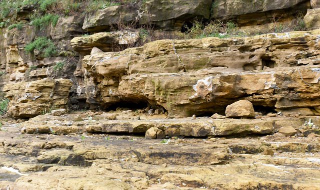

What followed, according to Erickson, was four years of investigation, planning and securing financing for the mandated repairs. In 2009-2010 the county spent almost four million dollars on a ‘grout curtain repair.’ The grout was pushed into the cracks under pressure to block the seep and stabilize the rock in the abutment.

Dam breach
“In the early morning hours of Tuesday, August 28, 2018, an area along the Vernon-Monroe County line received 13 inches of rain in a couple of hours,” Erickson explained. “This resulted in the breaching of three dams in Monroe County in the Coon Creek headwaters, and two of the dams in Vernon County in the West Fork Kickapoo headwaters, one of which was Jersey Valley.”
Erickson noted that the breach at the Jersey Valley Dam is believed to have started at about 4:30 a.m. below the auxiliary spillway. The erosion then worked its way backwards uphill into the hillside abutment of the dam. After the breach, the level of the lake behind the dam went down 15 feet. The height of the breach is 55 feet by the dam and eight feet by the spillway. He said that the breach moved 200 yards of material in about three-and-one-half hours.
Erickson explained that in 1969, when Jersey Valley was built, a 100-year storm, which is the specification that the dam was built to, would have been six inches in 24 hours.
Since that time, the county has used USDA-NRCS Emergency Watershed Protection (EWP) funds to clean out the channel from the end of the breach, and clean up woody debris, etc. They have built a temporary berm at the site of the breach to stabilize the lake level and protect the existing fishery.
Dam future
Looking at the future of the breached dams, Vernon, Monroe and LaCrosse counties have entered into a cooperative agreement to pursue funding for watershed studies of the West Fork Kickapoo and Coon Creek watersheds. This study, if approved, will assess the value of the structures for the purpose of flood control. The study would take into account new rainfall amounts and current land use in the basins that drain into the two watersheds.
One participant commented that the basic definition of the 100-year flood seems to need an update to reflect increased rainfall amounts. He asked if the breach was having an impact on the county’s floodplain zoning.
“There were definitely people outside of the 100-year floodplain that were impacted when the dam breached,” Erickson said. “Our zoning committee will be taking up this issue soon and asking the question whether we need to enact a breach route moratorium on development.”
“The DNR requires that the breach route be zoned as being in the dam’s hydraulic shadow until it is repaired or abandoned,” Monroe County Conservationist Bob Micheel clarified.
Economic concerns
Many of the dams in Vernon County double as recreational facilities, offering camping and access to fishing etc. Others are maintained as county forests, and provide the county with revenue from timber harvests. The county will have to factor these considerations into the vision for the future of the Jersey Valley Dam.
According to Erickson, “there is currently not a monetary value on the lake as a recreational resource. It is used extensively during the summer months for swimming, and year long for fishing.”
Erickson characterized the lake as “a major draw to the park, and clearly the nicest lake we have in Vernon County.”
“The lake at Jersey Valley is the deepest lake in the county at 34 feet, and therefore the least susceptible to underwater plant growth,” Erickson explained. “The depth of the lake increases water clarity and overall enjoyment, but it is still a ‘eutrophic’[rich in nutrients and so supporting a dense plant population, the decomposition of which kills animal life by depriving it of oxygen] system that does have algal blooms during the warm summer months.”
Erickson said that, in addition, the county park has other attractions such as hiking, bird watching, hunting, and downstream trout fishing.
“The watershed study may influence how and if the dam is repaired,” Erickson said. “This will likely influence the depth of a future lake, if there is a lake in the future.”
According to Nick Gilman, the revenue generated from the timber resource in Jersey Valley averages between $5,000 - $7,500 annually, depending on the year and active logging jobs. Some years may not generate any revenue and in others the county could see upward of $20,000.

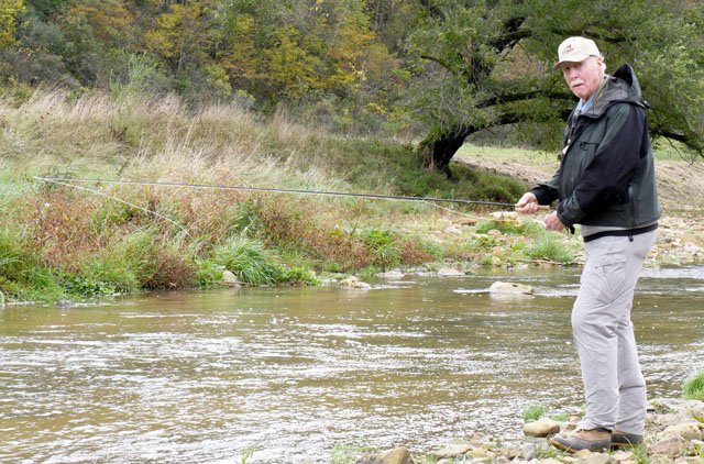
Streambank restoration
Vernon County Land and Water Conservation Department Conservation Technician Matt Albright discussed a streambank restoration project he had completed this summer just below the Jersey Valley Dam.
“The project cost $15,000 and was 50 percent funded from State of Wisconsin DATCP Soil and Water Resource Management (SWRM) funds,” Albright said. “In the process, we restored 500 feet of stream bank with riprap, and installed 15 lunkers. The rain and the dam breach actually moved the course of the stream, and left a straight versus meandering channel and vertical banks. Because of this, we knew that our work would need to focus on shaping the banks and revegetating the site.”
Richard Egan is the landowner where the project took place. Egen contacted Albright after the August 2018 flood to report that the breach had “totally blown the stream out.” According to Albright, that flood event ‘turned the stream into a ‘western stream,’ which was shallow and rocky.” Prior to that, according to the landowner, the stream offered “the best fishing in Vernon County.”
“I didn’t think what has happened to the stream as a result of this project was possible,” Egen said. “It seemed like a total disaster.”

“Matt did great work on this project,” Egen said. “There was a lot of paperwork involved to secure the funding, and Matt was incredibly patient in the design process, working with me in a highly interactive way and taking my ideas into consideration in developing his plan.”
Egen wanted the group of statewide conservation technicians assembled on his land to know that their work is highly appreciated.
“Fishermen appreciate what you folks do,” Egen said. “It’s not just the streambank restoration but also all you do to help create habitat as well.”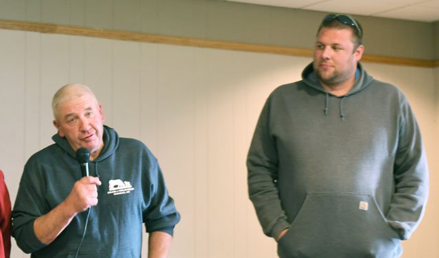

Watershed farmers
Over lunch back at the Viroqua VFW, the group had a chance to hear from some of the farmers of the Tainter Creek Watershed Council about what they saw as the challenges and advantages of participation in the group.
Grant Rudrud, Berent Froiland and Chuck and Karen Bolstad spoke to the group of technicians.
“Originally, it was the hard work of Matt Emslie of Valley Stewardship Network, going door-to-door, talking with landowners, that got us together,” Chuck Bolstad observed. “The key player in our watershed council is really dairy farmer Grant Rudrud – he walks the walk, and talks the talk.”
Bolstad explained that Rudrud had been named ‘Conservation Farmer of the Year’ recently. He stated that “Grant Rudrud is a great example for other farmers of someone who balances care for the environment with care for his farm’s bottom line.”
“The mission of our group is to improve water quality in Tainter Creek,” Bolstad explained. “Like Vernon County Conservationist Ben Wojahn often says, the real progress in conservation comes through micro-projects, and that is what our group is focused on.”
Bolstad went on to explain that the group couldn’t do what it does without the support of its many partners. He listed those partners as Valley Stewardship Network, Vernon County Land and Water Conservation Department, DATCP, U.S. Fish & Wildlife Service (USFWS) Fishers & Farmers Partnership, Trout Unlimited, and the Wallace Center Pasture Project.
Grant Rudrud explained that the group meets every-other-month-ish, and the meetings are pretty well attended. He was particularly enthused about how recently more young farmers had started to come to the meetings.
“Ben and Matt always bring us pizza and beer, and the farmers can visit and share tips with each other,” Rudrud explained. “Every meeting we are seeing more people, new people – young and old, organic, conventional, and grass-based, and there seems to be more and more interest in planting cover crops.”
Rudrud explained how the severity of the flash flooding in the Tainter Creek Watershed in a catastrophic rain event in September of 2016 had really provided the group extra motivation.
“We had more than 12 inches fall overnight along the Vernon-Crawford county line, and our roads were wiped out and our fences were just gone,” Rudrud remembered. “The bigger rains are becoming more devastating, and landowners need to think about how to reduce the amount of water running off.”
Rudrud commented that the use of the rainfall simulator in some of the council’s education events had really been a big eye opener for farmers in the watershed. The rainfall simulator shows the amount of water that runs off and the amount of soil that is lost under different land uses, varying from bare soil, to soil with post harvest debris left on the field, to pasturelands and fields planted in a multi-species cover crop.
“The members of our group want people moving into the area to be aware of the good things we’re doing,” Rudrud said. “We need them to know that we’re working hard to make positive changes, and ask them to be patient.”
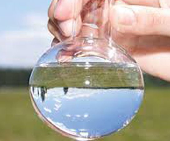
Vernon County Conservationist Ben Wojahn talked about the various sources of funding the group had received. He said the group had received a USFWS grant for cover crop installation. He also explained that the group had been pioneers among farmer-led watershed councils in the state in conducting groundwater quality testing using funds from DATCP.

Invasive species control
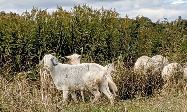
The last stop of the day was at the Duck Egg Dam where the herd of goats the county uses for invasive species control was currently staged.
Wojahn described the county’s partnership with goat herd owner Ben Roble as a ‘Public-Private Partnership for Biological Invasive Species Control.” He explained that using the goats owned by Roble is very cost effective compared to renting them from the DNR for $2.50 per day per goat.
Wojahn’s team is responsible for setting up and moving the fencing and goats at whatever site they’re staged at. He said, laughing, “my team is not always super enthused about having to go out and move the goats, but we all like the results we’re seeing of having them on our properties.”
Vernon County Forester Nick Gilman discussed the goats, and some of the projects they are used in.
“Goats can go where it is difficult for machines and humans to get to,” Gilman explained. “We have a problem with our forests in that invasive species are choking the understory and our oak stands are not regenerating.”
Gilman showed the tour participants an area that had recently been grazed by the goats, compared to an area right next to it where they hadn’t yet been.
“Now that the goats have knocked back the undesirable, invasive species in the understory, we can go in and do a tree planting project and the trees will get the sunlight that they need to grow,” Gilman said. “We’ve had three good years for acorn production and we also have a grant that will allow us to plant 775 red and white oak trees per acre.”
Gilman explained that the goat owner, Ben Roble, provides members of the Land Conservation Department with training about how to move the goats for a fee. The LCD staff moves the goats from paddock to paddock at a given site, and Roble transports the goats from site to site and provides the fencing system.