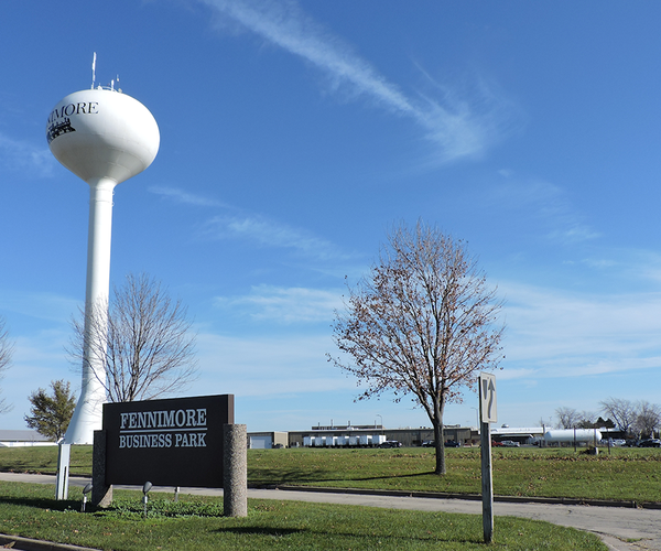
KICKAPOO VALLEY - Villages up and down the Kickapoo River Valley are faced with both short and long-term challenges in flood recovery and mitigation. The villages of Ontario, LaFarge, Viola and Readstown are going through what Soldiers Grove faced after the 1978 flood, and what Gays Mills faced after the back-to-back floods of 2007 and 2008. Floodplain zoning, buyouts, elevations, and infrastructure are big topics. Delays in funding are stressing residents and business owner’s patience.
However, the bigger picture of grappling with what some say is the ‘new normal’ is also a major focus of communities up and down the valley. Although there remains a broad spectrum of views about whether climate change is to blame for the large rainfalls the watershed has seen in recent years, most acknowledge that the 100-year or even 500-year floods seem to keep coming every year with no relief in sight.
Many say that a watershed-wide approach is the solution. Kickapoo Valley Reserve (KVR) Executive Director Marcy West is concerned that all of the local, state and federal agencies that are working on studies, grant applications and funding need to be on the same page and not operating in silos. For this reason, West called the second of what she says will be a series of valley-wide meetings with agency representatives from all levels of government.
The meeting invitation for the Tuesday, Nov. 19 meeting at the KVR included village officials from Ontario, LaFarge, Viola, Readstown, Soldiers Grove, Gays Mills and Steuben. The invitation also included representatives from the Wisconsin Department of Military Affairs, Department of Natural Resources, Department of Administration, and Department of Transportation; Mississippi River Regional Planning Commission; the Monroe, Vernon, and Crawford County Land Conservation Departments; U.S. Representative Ron Kind’s office; U.S. Senator Tammy Baldwin’s office; State Representative Loren Oldenburg’s office; State Senator Jennifer Shilling’s office; members of the Ho-Chunk Nation; Wisconsin Wetlands Association; Delta-3 Engineering; U.S. Environmental Protection Agency; U.S. Army Corps of Engineers and USDA-NRCS.
“What I wanted to do was get everyone under one roof to talk about all of the short and long-term recovery initiatives that are being considered,” West said. “My goal is to break down the silos, get everyone talking, and ensure that everyone is getting the same message.”
Long-term prevention
The August 2018 flood was historic in an area that has long experienced flooding and in recent years has braced for the near certainty of annual 100-year floods or worse. What made the August 2018 flood most noteworthy in a crowded field of candidates for ‘worst flood ever’ was the breaching of two flood control dams in the headwaters of the West Fork Kickapoo River and three in the headwaters of Coon Creek.
USDA-NRCS, whose predecessor agency, the Soil Conservation Service (SCS), seemed to sit up and take notice when the dams failed. The dams in our area are part of a network of 12,000 dams nationwide built by the SCS, and the manner in which they failed was “unprecedented,” according to agency officials.
It seems likely, according to Monroe County Conservationist Bob Micheel, that the national USDA-NRCS office will approve funds for a study of the two watersheds where the dams failed. These studies would be similar to watershed-wide studies that were undertaken by multiple state and federal agencies prior to the dams being built in the 1960s. One key factor will be taking into account the ‘new normal’ of rainfall amounts and a possible redefinition of what constitutes a ‘100-year storm and flood.’
The U.S. Army Corps of Engineers (USACE) was also on the scene in September of 2018 following the breach of the dams. Their purpose in being present was to take measurements immediately following the event for use in calibration of a possible study of the watershed.
Historically, SCS and USACE had jurisdiction of different parts of watersheds. SCS lived in the Department of Agriculture, and focused on land use and soil erosion in the tributaries of a watershed. USACE was focused on engineering and flood control on the main stems of watersheds. This is why SCS was responsible for building the PL-566 dams in the West Fork and Coon Creek, but the USACE was the agency leading construction of the LaFarge Dam on the main stem of the Kickapoo River.
Constructed wetlands
Most recently, the U.S. Environmental Protection Agency (USEPA) has become interested in exploring the possible use of constructed wetlands in the Kickapoo River Watershed for flood mitigation and water quality improvement.
Readstown, like all the villages in the Kickapoo River Valley, is under phosphorous reduction requirements at their water treatment plant that doesn’t seem achievable with the current infrastructure. Like most villages, upgrades to their water treatment infrastructure seem financially unrealistic.
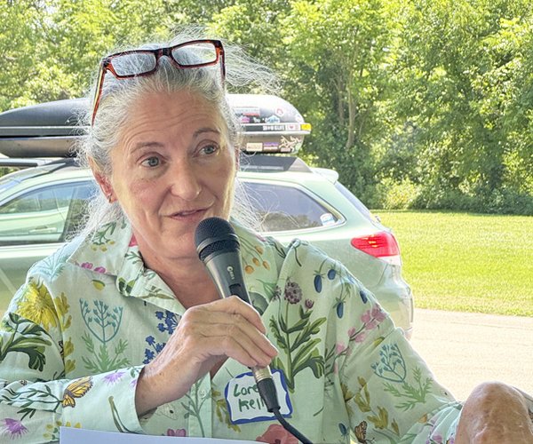
For this reason, Readstown Village Clerk Susan Mueller began to explore possible ways to use natural systems to remove the phosphorous and other nutrients from the water before it reaches the village’s treatment facility. She joined with others to invite the USEPA to speak in Readstown on Monday, Nov. 4.
Cissy Ma from USEPA spoke to a crowd of about 30 people about the research the agency has undertaken on the use of constructed wetlands in other communities.
“Using wetlands to work with water treatment plants to achieve reduction requirements of nutrients like phosphorous and nitrate is employing the approach of biomimicry,” Ma told the group. “Biomimicry is the design and production of materials, structures, and systems that are modeled on biological entities and processes.”
According to the USEPA website, ‘constructed wetlands are treatment systems that use natural processes involving wetland vegetation, soils, and their associated microbial assemblages to improve water quality.’
“Every watershed is unique in the challenges and issues it faces,” Ma said. “In the Kickapoo River Valley, your main challenge is your terrain which causes rapid runoff in extreme rain events, and also carries nutrients more quickly into the surface waters.”
Ma told the group that the Water Infrastructure Finance and Innovation Act of 2014 (WIFIA) established the WIFIA program, a federal credit program administered by EPA for eligible water and wastewater infrastructure projects. WIFIA and the WIFIA implementation rule outline the eligibility and other requirements for prospective borrowers.
“It is expected that by 2022, through the WIFIA program, there will be $40 billion allocated for infrastructure upgrades,” Ma told the group.
At the November 19 meeting at the KVR, Ma informed the meeting participants that she plans to submit a request for funding for a research project in this region. The research, according to Ma, will be focused on how to address multi-source runoff, discharges, effluent, sewerage treatment and uplands land use.
Staff from the WDOT, who were present at the meeting, were attending because of their potential interest in using ‘wetland banks’ to offset impacts during highway construction projects. While they have no major highway projects planned for the region, they are “always interested in the region and what may impact road infrastructure.”
Past studies
Monroe County Conservationist Bob Micheel pointed out to the group that work had already been done to study the watershed. He said that research had been completed in the late 1980s when the Kickapoo River Valley was designated a ‘Nonpoint Source Control Priority Watershed.’
“The study in 1989 dealt with all the same issues that are facing us today – water quality, flood mitigation, point and nonpoint source pollution, floodplain zoning, runoff reduction and reconnecting the streams to their floodplains,” Micheel said. “The problem always seems to be that the land use solutions that are put in place are completely voluntary and are not kept in place over time.”
The plan developed in 1989 was called ‘Nonpoint Source Control Plan for the Middle Kickapoo Priority Watershed Project.’ It was prepared jointly by WDNR and DATCP in collaboration with the Land Conservation Departments from Monroe, Vernon and Richland counties, UW-Extension, and the SCS (which changed its name to NRCS in 1994). Funds to implement the plan came from the ‘Nonpoint Source and Water Pollution Abatement Program,’
The introduction to the plan created then could easily serve as the introduction to a plan written now. What needs to be factored in are the elements of increasingly large and destructive rainfall amounts experienced in recent years, as well as the loss of animal agriculture and land in pasture or hay.
Tim Hundt from Congressman Ron Kind’s office told the group that their office is considering the best methods to implement a watershed-wide coordinated effort. He encouraged members present at the meeting to “think about options for a locally driven, locally managed entity that would lead watershed-wide mitigation efforts,” and to contact their office with any ideas.
It was agreed at the November 19 meeting at the KVR that at minimum, it is essential to get leaders from the Monroe, Vernon and Crawford Land Conservation Departments together to prioritize projects and approaches.