
An all-star cast of cutting edge experts assembled in Cashton on February 21 for the ‘Resilient Ag & Rural Landscapes’ workshop. The event was intended to help agricultural producers find resources to understand the changes that seem to be coming so quickly, help to manage runoff and nutrient loss, pursue soil health and protect water quality, and foster greater profitability in their farming operations.
Among the featured speakers were:
- Sheri Schwert, UW-Extension Ag Water Quality Outreach Specialist
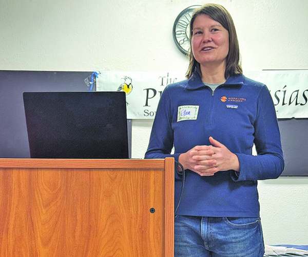
- Josh Bendorf, Climate Outreach Specialist with the State Office of Climatology
Water quality
Sheri Schwert explained to the group of almost 50 citizens assembled in Cashton that her goal was to help producers understand how the changes in climate being seen, and predicted to intensify, will impact agriculture and surface water quality.
“Our climate is getting warmer and wetter,” Schwert explained. “Water Quality 101 is that in order for us to have runoff and impact surface water quality, we have to have a source and a transport.”
Schwert explained that the ‘source’ is cropland, pastures, wooded acres – any surface where you can have water and nutrients running off your farm. She said that ‘transport’ comes in the form of precipitation onto those surfaces.
Schwert described the work of Discovery Farms, using ‘edge-of-field’ monitoring devices. She said the device is basically a flume, placed at the edges of fields, that captures runoff and measures a lot of different factors. She explained that the facts she would present come from data from these devices from all over the state.
“We know that our transport is increasing because our precipitation is increasing,” Schwert stated. “Our days with more than one inch of rain in 24 hours are increasing.”
She said that it isn’t the big and more rare events, like the ones that damage infrastructure, that are the biggest concern. It’s the smaller events that happen consistently that are the ones it is possible to address with land conservation and soil health measures.
“An increase in precipitation just generally increases our opportunities for soil and nutrients to move off our fields,” Schwert explained. “If we dig down into our seasons, one of the most important trends when it comes to ag water quality is the upward tick in springtime precipitation. A lot of our counties in Southwest Wisconsin are seeing a 20% increase in the amount of precipitation that they get in the months of March, April and May.”
Most vulnerable
Schwert explained that the Discovery Farms data shows that springtime is the most vulnerable time of year when it comes to runoff and nutrient loss. She said this is especially true in the months of March and May. Why those months?
“The highest soil losses in pounds/acre come in May, after the fields have been planted, but before the crops have significant growth,” Schwert explained. “We also see significant losses in March, when we often see snowmelt or precipitation, but the ground remains frozen.”
Schwert said that generally, we are losing most of our soil across the state in May, but we're also losing the majority of our phosphorus during the springtime.
She explained that there are two types of phosphorous lost – particulate and dissolved.
“We have dissolved phosphorus and particulate phosphorus. Both of them together make up total phosphorus,” Schwert said. “Particulate is what moves with soil, and that is where we see more loss. Dissolved phosphorus is more difficult to deal with. Dissolved phosphorus is when you can have runoff moving off the field. It might look clear. It might not have any soil in it, and it can still be carrying a lot of phosphorus, because it is literally dissolved into the water.”
Schwert explained that if there is high soil test phosphorus on a field, the highest place where that soil test phosphorus is going to be is right at the surface. Phosphorus comes in with the plant, with that biomass, and then it doesn't move down the soil column, the same way that say nitrate does – it stays where it was put.
“So that means the very top surface of our soil really often has high phosphorus values,” Schwert stated. “If you do have vegetation on a field, if you have a winterkill cover crop, the phosphorus is in the plant, and when that plant dies and all of the cells break because it's frozen, it releases that phosphorus. Once it melts or thaws, it readily dissolves into water and moves off the field.”
“Generally, what you need to know is, we have soil loss happening in May and we have phosphorus loss happening in March,” Schwert emphasized. “We're seeing an increase in spring precipitation, and it's the reason we see this run, because in our traditional cropping system, this is a time of year we don't have a lot of cover on the ground.”
What can we do?
“So what can we do about it?” Schwert asked. “We can protect water by protecting soil.”
Schwert used the example of a triangle or ‘pyramid’ to demonstrate a layered approach to controlling soil erosion, runoff and nutrient loss from your acres. The first step would be at the widest part of the triangle, at the bottom, which would be to implement ‘foundational’ practices on your agricultural acres, such as rethinking tillage.
Schwert explained the different approaches to tillage common in agricultural production systems. Conventional tillage is at least one tillage pass with common tillage implements like chisel, flower disc, or moldboard. Reduced tillage is at least one tillage pass with implements or techniques meant to reduce soil loss. Rotational no-till is a year when tillage was not used, for instance with alfalfa. True no-till means no tillage the entire time, and usually for years.
“Our data shows that in tillage systems, those fields are much more vulnerable to extreme soil loss incidents,” Schwert explained. “We don’t see these extreme losses with rotational and true no-till, and that's why no-till can be a really good foundational practice for protecting soil. But you have to keep an eye out for concentrated flow.”
Schwert shared an example of a no-till field, with cover crops, that nevertheless showed up in data with a high soil loss because a gully was forming, creating concentrated flow off the field. She said in that case, the problem was corrected through installation of a grassed waterway.
“Now they not only have no-till and a grassed waterway, but they also have cover crops,” Schwert pointed out. “This layering was necessary to reduce soil loss on these fields, and would constitute another erosion prevention practice layered onto the foundational no-till practice.”
Variety of practices
Schwert said there are a variety of practices that producers can use – the next layer in the pyramid – to be more protective of soil. Those can include grassed waterways, riparian buffer strips, filter strips, edge-of-field native prairie plantings, and grade stabilization structures.
“These practices can work, but often take some acres out of production, which nobody really wants to do,” Schwert observed. “Nevertheless, they can have a really outsized impact on reducing nutrient loss and soil loss.”
She said often producers will target these kind of practices to parts of the field that aren’t hitting yield goals, and don’t justify the expense of planting them into cash crops. She said these kinds of practices are definitely effective for water quality.
Finally, Schwert emphasized, that the indispensible top tier in the pyramid of layered practices for preventing erosion and protecting water quality is to practice consistent field walkovers.
“Discovery Farms has a publication, ‘Your Field Walkover Guide,’ which goes through the steps of looking for concentrated flow areas,” Schwert shared. “It includes looking for sheet erosion, checking your grassed waterways to ensure they’re in good shape and functioning well, checking stream banks, looking for gullies in wooded areas below fields, and more.”
“Layering conservation practices is really valuable, because they can have different benefits for different times of year and for different reasons,” Schwert emphasized.
Resources available
Schwert’s presentation had followed a presentation by Josh Bendorf, Climate Outreach Specialist with the State Office of Climatology, about resources for agricultural producers designed to help them respond to changing conditions.
“Our office does climate summaries for counties on a per-request basis,” Bendorf told the group. “Monroe County is one of our Central Wisconsin reports along with La Crosse County, and for counties in Southern Wisconsin, we’ve done Vernon and Sauk counties in the western part of the state.”
A county climate summary contains pages on:
- Averages and Records
- Temperature Trends
- Temperature Top 10
- Precipitation Trend
- Precipitation Top 10
- Extreme Heat
- Extreme Cold
- Extreme Precipitation
- Hazards Summary
- WICCI Projections
- USDA Midwest Climate Hub
- Ag Weather Outlook for Wisconsin
- Wisconet
Bendorf also highlighted different reports and services that can assist municipalities, and farmers and landowners pursue greater resilience in the face of cli-mate change impacts. Those resources include:
- Ag Weather Outlook for Wisconsin – monthly in winter, and weekly during the growing season (https://cropsandsoils.extension.wisc.edu/wisconsin-ag-weather-outlook/)
- Wisconet Network – real time (updated every five minutes) above ground air temperature and wind speed, and soil moisture and temperature at different depths going down to 40 inches (https://wisconet.wisc.edu/)
Climate trends
Bendorf shared trends in the climate summary presented to citizens at the ‘Resilient Ag & Rural landscapes’ workshop, that are broadly true for most of southern Wisconsin:
- from 1996 to 2025 (last 30 years), annual temperatures have increased at a rate of about one degree Fahrenheit every 25 years, with warming the most pronounced during the winter months
- in summer, along most of the other seasons, low temperatures have been warming at a similar or faster rate compared to high temperatures. They have also seen a substantial increase in overnight temperatures and a substantial decrease in extreme coldest temperatures
- annual precipitation has been increasing at a rate of about an inch per decade, a 21% increase since the early-to-middle 1950s, with summer seeing the largest increase in terms of inches per decade
- winter is actually the season with the largest percentage increase in precipitation – about 31%. Summer tends to be the wettest time of year, and winter is our driest. So even a little bit of increase in winter precipitation is more significant compared to summer
- about 82% of extreme precipitation events occur in the months of June to September. Temperature and moisture in the atmosphere are very closely linked. June has stood out a little bit more as the month of most frequent heavy precipitation days, but months like July and August don't fall too far behind
- climate predictions for mid-century, under moderate greenhouse gas emissions, with temperatures continuing to increase by about four degrees compared to recent averages, suggest that winter will warm by a little bit more than other seasons, with a decrease in the number of nights that drop below zero, and there will be an increase in warm nights and days that top 90 degrees in summer
- summers are projected to be five percent drier, but even with summers projected to be slightly dry, that can be a little bit deceiving, because that's also the time of year when we're most likely to see heavy precipitation events, and precipitation events greater than two inches are predicted to increase in frequency.