DRIFTLESS - Last week, the Independent-Scout featured Curt Meine’s remarks about the potential impacts to the Driftless Region from the proposed MariBell and BECI 765 kV transmission lines. Curt Meine is co-editor of ‘The Driftless Reader,’ and his talk aimed to enhance historical understanding of the unique wildlife ecology in the Driftless.
This week, we will share the remarks from the other two members of the panel from ‘Nature on the Line,’ held on October 25 at the North Crawford Performing Arts Center. Another ‘Nature on the Line’ event is planned in Prairie du Sac on Tuesday, November 17, from 5-8 p.m., at the River Arts Center, Leola Hall.
Those two panelists are Neil Rettig, who spoke about the richness wildlife in the Driftless Region; and Forest Jahnke of Crawford Stewardship Project, who spoke about the Driftless Region’s vulnerable karst geology and the world-renowned drinking water contained in its aquifers.
Rich in wildlife
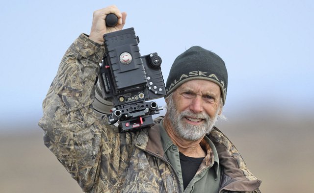
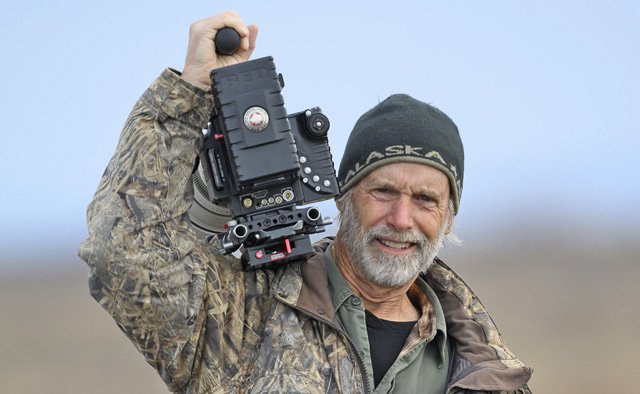
Rettig is a world-renowned, six-time Emmy Award-winning wildlife cinematographer. His fieldwork has been instrumental in the conservation of rare and threatened animals, the establishment of protected ecosystems around the world, and breeding projects for endangered species.
“It’s great to see this large crowd here today for a very, very important war that we're fighting against this proposed 765 kV power line,” Rettig told the crowd. “I'm going to talk mainly about the aesthetic values of the wildlife here.”
Rettig said he’d first come to the Driftless on a film assignment about the Mississippi Queen passing by on the river at Prairie du Chien.
“I was completely blown away by how magnificent this area was. Several years later, I moved to Wisconsin and bought a 162-acre farm,” Rettig remembered. “Since then, my wife Dr. Laura Johnson and I have been managing that farm for wildlife, planting tall grass prairie, burning, making brush piles for hunting and for flying our trained birds of prey.”
Rettig said he and his wife are falconers, and said they've been enjoying making the land into a sanctuary for wildlife. Rettig, who works as a cinematographer all over the world, said he is always pleased when he gets back home to the Driftless.
One of the films Rettig is most proud of is, ‘Mississippi: Tales of the Last River Rat.’ The film is a celebrated wildlife and nature documentary, originally released as part of the BBC's ‘Natural World’ series in 2004. Rettig showed a clip of the film featuring spectacular shots of wildlife in the Mississippi River backwaters near Alma.
Rettig said working on that film had given him a great opportunity to learn about the magnificent bald eagle, and he has since worked on more films about the species.
“The bald eagle is a bird that is very, very vulnerable to mortality by hitting transmission lines and electrocution,” Rettig stated. “I read a recent paper that was published out of a study done in Maryland a few years back, and during that project they discovered that bald eagles were really susceptible to lines that are high above the tree canopy. Certainly, at 200 feet off the ground, these lines would be incredibly deadly. Not just with electrocution, but with just simple collisions. When an eagle is either chasing another eagle or going in a straight line in a hurry, they can easily hit a power line, and that's the end of that. And unless these lines are monitored and carcasses are picked up and counted, no one really knows. There's really a lack of studies on utility collisions with large birds.”
Rettig made clear that it is not only bald eagles that would be threatened, but also waterfowl and cranes, pelicans, and any large bird whose flight corridor is high up off the ground. He said the bird’s flight corridor would put them right in line with the “deadly power lines.”
Golden eagles
“A very interesting study is being done by a group called Raptor Research Project (RRP) that was formed by the late Bob Anderson,” Rettig shared. “Not many people know it, but there's a very unique population living right here in the Driftless during the winter of golden eagles.”
Rettig said golden eagles are a very little studied population of eagles that breeds in the far north in Canada, around Hudson Bay. He said the eagles migrate right to this area, and the Driftless has an absolutely incredible population of them.
“The transmission line would certainly put this population under extreme danger,” Rettig observed. “There have been quite a few studies of golden eagles out west, and they are very susceptible to collisions and electrocutions. Being a large bird, with a seven-to-eight-foot wing spread, they can often touch two conductors and that will electrocute them on the spot. But collisions are a big thing as well. Just like the bald eagle, and even more so, golden eagles are flying at high speed sometimes, chasing a duck or other prey, and they'll collide with that wire.”
Rettig said that wildlife like the large raptors are already facing a gauntlet of threats, and the proposed path of the transmission line is right where they overwinter.
“We have such an incredibly risky proposal coming with this high tension line that it it makes me really apprehensive about the future,” Rettig shared. “And this is happening in a time when all of our laws seem to be becoming less stringent and more relaxed about environmental protection. It's a time that we've got to buckle down to do more to help protect our plants, animals, and wildlife from these kinds of threats.”
Rettig said that all his life, he’s been chasing the light in photography and looking for that perfect, clean horizon line – looking for scenery that doesn’t have a man-made structures in it.
“It’s getting harder and harder to find, and certainly, if this transmission line goes through, it's going to be a blight on the horizon,” Rettig stated. “That's going to spoil so many magnificent views, decrease land values, and probably turn off a lot of tourism to this area.”
Rettig told a story about a film assignment he’d been on in Washington State. He said it was late in the day, and so the film crew stopped work to watch a falconer fly his white gyrfalcon.
“The bird was up at about 500 feet, and a covey of quail flushed right near us, the covey went in the air, and that falcon came down. We were all mesmerized, watching it stooping at 150 miles an hour,” Rettig remembered. “It hit a power line and cut itself in half. I'll never forget that as long as I live. The falconer instantly put the bird to death. That image will never leave my mind.”
Rettig said that whenever he thinks of that experience, he think of all these power lines, transformers and things that are killing birds of all species, and especially large predatory birds around the world.
“I just hope all of us can fight and fight our best to prevent this blight from going through on the horizon,” Rettig concluded.
Karst geology
Crawford Stewardship Project’s Forest Jahnke has become a local authority about the Driftless Region’s karst geology in his many years of fighting to protect its drinking water aquifers.
Jahnke said he’d go over the basic hydrogeology of the Driftless, and discuss what makes it unique.
“Karst gets bandied about a lot. I think even 10 years ago, it was not really part of the common understanding. So, it's been really great to see a growing understanding of this geology that we have here,” Jahnke said. “While it’s not unique, it is very special, and the layering we have here makes a really unique combination that gives us all these special ecosystems, soaks in water, and makes it flow in all sorts of complicated ways.”
Jahnke explained that ‘karst’ is a feature of calcium carbonate bedrock, which is very easily dissolved by acids in water. He said that over time, weak acids in rain water eat away at the calcium carbonate rock to form the various features associated with karst such as vertical and horizontal cracks and fissures, sinkholes, caves, underground rivers, springs and seeps.
“It's very complicated, and this area has not really been studied to the extent that some of us would love to see. If it were, it would help us really understand,” Jahnke said. “So, I'll be talking in generalities. At any given point, we don't know if there's a cave underneath us - there's places where it will be more or less likely, but we don't really know what's going on below, five-and-a-half-feet below our feet, unless you happen to have done your own studies.”
Jahnke explained that the bedrock layers we’re taking about evolved over roughly half a billion years. He said the whole thing was laid down on top of the hard, crystalline granite ‘basement layer’ of rock about 500 million years ago. On top of that, he said, you have the Cambrian and Precambian sandstone layers, where our drinking water aquifers are located.
“This area back in the day was a tropical sea, a very shallow sea, and all these shallow sandbars and the wind blowing them around formed very well-rounded, well-sorted, silica crystal balls that became our sandstone. If you think of a bucket of marbles, you can fill that up with a lot of water because between those balls there's a lot of pore space. So that formed one of the best aquifers in the world that we are sitting on top of and drinking out of.”
Jahnke explained that over the years, sea levels would go up and down. He said that when it was shallow, sandstone layers would form, and when the water went up and everything was under water, then the life in the ocean would form the carbonate bedrock.
“All the dolomite, all the limestone, all these karst landforms are essentially one giant fossil. It's an ancient seabed, and all the shells and bodies and slimes of these ancient organisms formed that layer of bedrock,” Jahnke explained.
Jahnke said that while sandstone doesn’t dissolve the same way carbonate bedrocks do, if the carbonate below a sandstone layer collapses, then it may appear that a feature like a cave or sinkhole has developed in sandstone.
“And then we have springs, which is essentially the connection point where groundwater becomes surface water,” Jahnke explained. “Springs come in all different forms, from those that bubble out of a hillside, to those that bubble through sand, and more.”
Jahnke explained that there are some 3,300 mapped springs in the Driftless Region, but because visible springs fluctuate with the water table, there are likely many more.
“We are not unique in having this karst geology. There are many areas. In fact, about 20% of the globe has karst bedrock somewhere in the mix,” Jahnke explained. “Here in Wisconsin, almost a third of the state in eastern, southern, and western Wisconsin has this kind of geology.”
Jahnke said that one thing that varies, and is consequential to groundwater quality is the depth of soil to bedrock. He said that in the Silurian karst typical in eastern Wisconsin, many areas have more than 50 feet of soil on top of bedrock, whereas in western Wisconsin, there are very few areas that have more than five, ten, or 20 feet if you’re very lucky.
“The soil is a sponge. The roots in the soil also act as ways to soak up and cycle the things that go in on the surface, rather than it hitting that karst bedrock,” Jahnke explained. “Once the water and whatever it's carrying goes into the karst bedrock, it can flow very quickly and very unpredictably in all sorts of ways.”
Jahnke said that, for this reason, the idea of sinking footings for transmission towers 40-100 feet into the ground, with investigative borings of, perhaps, only 50 feet is a risky proposition. Not only does the weight of the structure risk causing a collapse of the fractured karst bedrock, but it also becomes a direct conduit for toxic materials at the soil’s surface to be conducted down into the deep sandstone aquifers that supply most people’s drinking water.
Jahnke emphasized that Vernon, Crawford and Richland counties have access to the most up-to-date sophisticated LiDAR imaging, which landowners can use to identify potential karst features on their land. Those LiDAR-identified features can then be ground ‘truthed’ by walking out and taking a look. Jahnke says there is a tutorial available on YouTube which can assist landowners in learning how best to use the LiDAR data, which is typically available on county websites.