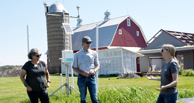
IOWA CITY - Members of the Monroe County Climate Change Task Force, and staff from U.S. Fish & Wildlife Services, Wisconsin DNR, Wisconsin Land+Water, and Wisconsin Emergency Management took a trip to the Iowa Flood Center in Iowa City on June 29-30.


Monroe County Conservationist Bob Micheel made a presentation to the Iowa City folks, talking about the history of the Climate Change Task Force, the reason for its existence, and their objectives and accomplishments to date.
“In the Driftless Region of Wisconsin, we’ve experienced more than 20 severe rainfall events that have caused millions in damages since about 2007/2008,” Micheel explained. “In Monroe County things really ramped up in 2018, and in 2019 we received five-to-six inches of rain in about one-and-one-half-hours. This rain event, and the damages it caused, catalyzed the formation of our Task Force.”
Since that July 3, 2019, rain event, the Monroe County Board unanimously passed a resolution affirming that human-caused climate change is impacting Monroe County, and authorized the formation of the Climate Change Task Force.
Micheel explained that the Task Force’s efforts have focused on improving data collection on watersheds, developing improved weather alerts for the public, repetitive damage structure buyouts, improvements in permitting of stream crossings through zoning, a stream crossing inventory, and more recently, a focus on improving soil carbon sequestration.
Micheel explained that the Task Force had received a presentation from the Iowa Flood Center at a meeting. He said that one of the Task Force’s goals has been to travel to Iowa to learn more about the Center’s efforts to build flood resilience in that state.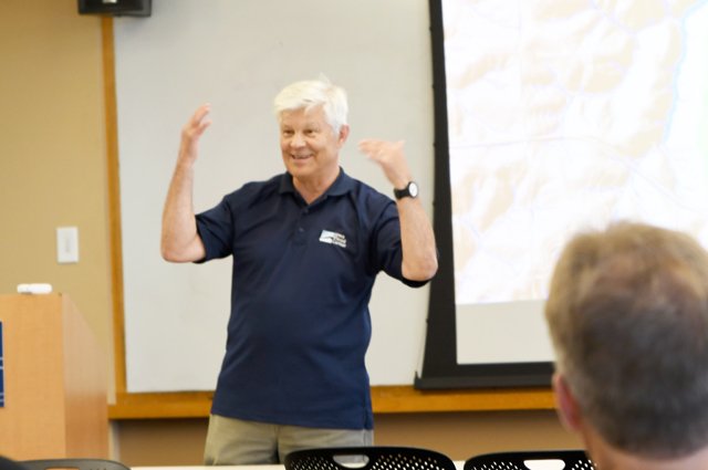

The current director of the Iowa Flood Center is Dr. Witold Krajewski. He is a professor of civil and environmental engineering in the University of Iowa College of Engineering. He also holds the Rose and Joseph Summers Chair in Water Resources Engineering and is a faculty research engineer at IIHR—Hydroscience & Engineering, and he was elected to the National Academy of Engineering in 2021.
His research focuses on rainfall monitoring and forecasting using radar and satellite remote-sensing, hydrometeorology, and water resources engineering.
Krejewski is a man with a keen intelligence shining out of his eyes, and a ready smile. According to one Flood Center staff person, “he’s always thinking.”
The Iowa Flood Center was formed in 2009, following a catastrophic flood event that devastated the Cedar River watershed in Iowa. The Cedar River reached a historic crest of 31.12 feet in Cedar Rapids, almost 20 feet above flood stage.
“The 2008 flood was very frustrating for me, because even though I’m an expert on heavy rainfall and floods, there was nothing I could really do with my professional knowledge,” Krajewski said. “So, during that event, I helped with the sandbagging.”
That June flood event was followed by winter storms in January 2009, which dropped 10 inches of snow statewide in just five days.
“The 2008 rainfall and flooding, combined with the huge volume of snowfall in the winter of 2008 and 2009, and the subsequent melt, were really the catalysts for the formation of the IFC,” Krajewski explained. “It was during the 2008 flood incident management and recovery process that the folks at IIHR really came to the attention of state legislators looking for solutions for their constituents.”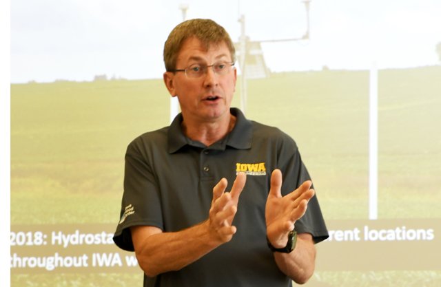

Dr. Larry Weber, whose love of ice cream is famous, was the first director of IFC, and worked closely with the legislature and colleagues at IIHR to secure the funding that allowed the IFC to begin operations. Iowa Governor Chet Culver signed the legislation establishing the IFC in 2009.
Dr. Larry Weber is an expert in flood-related research, watershed modeling and nutrient management. He served as IIHR director from 2006 to 2017, and he currently serves as principal investigator for the Iowa Watershed Approach. In 2009, he co-founded the Iowa Flood Center with Dr. Krajewski. In 2013, he worked with Iowa Legislature and Iowa State University to establish the Iowa Nutrient Research Center.
“The IIHR building, which is located right on the banks of the Iowa River, was ordered to evacuate during the 2008 flood,” Weber remembered. “I remember being down in the basement, working with the team to get our equipment out and the windows were boarded up. At that point, the river level was 26 feet above where we were, and we could hear giant logs banging on the windows.”
Funding received
The State of Iowa was able to secure $90 million in Community Development Block Grant funding for flood recovery. According to Weber, because of what IIHR was able to offer in flood recovery innovation, $10 million of the funds was used to fund the Iowa Flood Center, and allow them to begin operations.
Of that original $10 million, $400,000 was spent on outreach and education, $800,000 on watershed management, and $8.8 million was spent on a flood reduction pilot study. The pilot focused on installing flood reduction structures in watersheds over the course of five years, with $3.8 million spent on technical services, and $5 million on installing flood reduction practices on the landscape.
In 2010, IFC released the first community-based flood inundation maps for Iowa City, Des Moines, Cedar Falls, Waterloo and Elkader, Iowa. The maps went beyond simple floodplain and shoreland zoning maps, and provided Iowa citizens, municipalities, and emergency managers with detailed information about the extent and depth of predicted floodwaters.
Following this, IFC and Iowa Department of Natural Resources (IDNR) received another $15 million from the U.S. Department of Housing & Urban Development (HUD) to update floodplain maps throughout the state. The maps would show the probability, extent and depth of flooding for every Iowa stream draining more than one square mile. The project was completed in 2016.
“When we developed the maps, we used FEMA formulas for estimating damages because by doing so, in the end, we could get FEMA to approve our improved maps,” Krajewski remembered. “Development of the maps is very time intensive, and requires our staff to spend lots of time on the river in a boat measuring elevation, velocity and topography.”

Stream sensors
Also in 2010, IDNR contracted with IFC to build and deploy a network of 50 stream sensors in the state. Students designed and built the initial prototype for the sensors, which measure stream height via ultra-sonic sonar. Measurements from the sensors flow every 15 minutes to the online visualization web flood platform, the Iowa Flood Information System (IFIS), also built and made available to the public by the IFC.
“These sensors supply real-time, statewide streamflow forecasts,” Krajewski explained. “Results from the stream sensors are available on our IFIS website, along with inundation maps, and flood alerts.”
IFIS launched to the public in May of 2011. In 2014, IDNR funding allowed the network of stream sensors to be expanded to over 200. As of 2022, this number has increased to 250.
“IFIS integrates steam flow data from U.S. Geological Survey gauges and our stream sensors with National Weather Service rainfall data,” Krajewski said. “The results is we make Iowa citizens lives better and we make the job of Iowa leaders easier.”
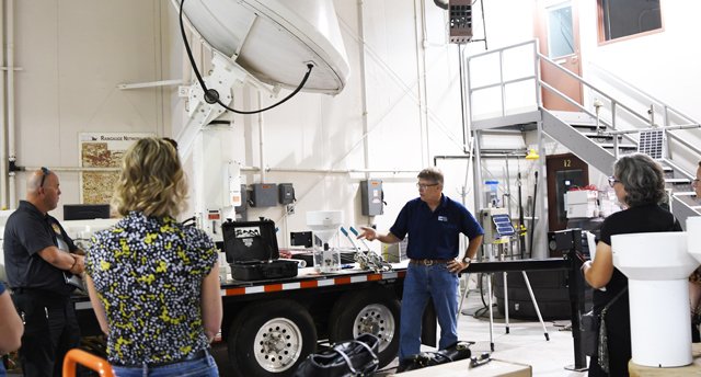
Dan Ceynar is the ‘wizard behind the curtain’ of the process to build and deploy the IFC’s stream sensors. He said he has been deploying the sensors since the very earliest days, and all of them are still fully functional and quietly sending measurements to the central database every 15 minutes of every day. He said that only recently, he’d had to go back to the earliest sensors deployed to upgrade their modems, and they were “just as good as new.”
Monroe County Land Use Planner Roxie Anderson was one of the team that travelled to Iowa City. Anderson has been point for the county in securing grant funding, sourcing and deploying the county’s growing network of stream and rainfall sensors. For this reason, she was particularly interested in Ceynar’s presentation and in viewing his facility.
“Dan's presentation of the development and implementation of the stream-stage sensors throughout Iowa showed us that we are on the right track to implementing our flood monitoring system,” Anderson said. “The amount of resources and time the Iowa Flood Center has taken to develop their own in-house sensors and flood monitoring system also made us realize that this is long-term planning process, and will take strong partnerships and a steady amount of funding to be successful. We also learned that we will periodically encounter challenges using real-time technology, due to ever-changing web services and cellular technologies.”


Flooding continues
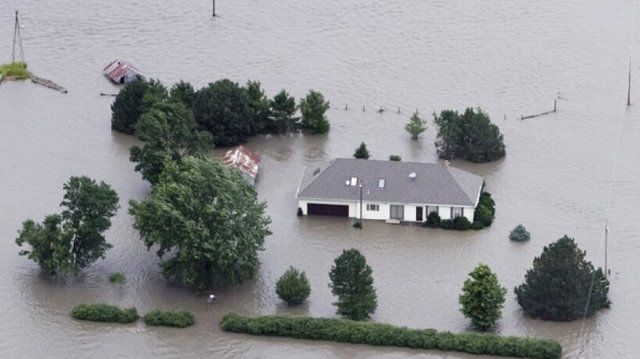
Since the original 2008 flood that catalyzed the IFC’s formation, flooding continued to strike in Iowa. In 2010, Ames received over 14 inches of rain in four days, with catastrophic flooding following. In Spring of 2011, flooding on the Missouri River in western Iowa resulted in a presidential disaster declaration affecting six counties. In 2014, historic flooding on the Rock River in northwest Iowa devastated communities, and overwhelmed drinking water systems, sewer treatment plants, and animal feeding operations, and more than 700 residents of Rock Rapids had to evacuate their homes. In 2015, a series of rare winter rainstorms caused more than 100 flood alerts in Iowa, and flooding in Iowa, Missouri, Illinois and Arkansas, which forced thousands to abandon their homes and took 20 lives. In September of 2016, the Cedar River again had a historic flood, with its second highest ever crest of 21.95 feet. In this flood, the IFIS system crashed due to the high volume of citizens seeking to access flood information.
Weber remembers in the aftermath of Super Storm Sandy in 2012, the U.S. government announced a ‘disaster resilience competitive grant’ which would be funded for a total billion dollars - $500 million from HUD and $500 million from the Rockefeller Foundation.
“We worked with the Governor’s office to develop our proposal to secure funding through this competition,” Weber remembers. “In the end, we were required to remove all references to climate change from the proposal.”
Weber said the IFC team was required to participate in the HUD and Rockefeller Resilience Academies, and part of the process was facing a ‘shark tank’ panel of proposal reviewers to pitch their proposal.
“We ended up being the fourth largest recipient of funding in that round with an award of $96 million,” Weber said. “Of those funds, we used $40 million to install practices in 80 watersheds, $40 million to upgrade urban infrastructure, and the rest on outreach and education and other projects.”
In 2018, Iowa had its third wettest fall on record, with precipitation totals almost 10 inches above normal, and 27 counties across northern Iowa experienced their wettest year on record. Then, in the March of 2019, a bomb cyclone struck the Midwest, and caused historic flooding on the Missouri River, breaching 62 levees and the U.S. Army Corps of Engineers dam in Niobrara, Nebraska. That flooding devastated the communities of Hamburg and Pacific, and caused $1.6 billion in damages. Later that year, the Mississippi River at the Quad Cities set an all-time record, cresting at 22.63 feet, and surpassing flood levels recorded in 1993.
“The Missouri River crested three times in the March 2019 event, and USDA provided the IFC with funding to take 3,600 acres of agricultural land permanently out of production in those hard-hit areas,” Weber remembered. “After we announced the funding, we got farmers with 30,000 total acres asking to apply, and we had to turn them away and see those acres go straight back into production.”
The acres permanently removed from production, according to Weber, were put in a perpetual wetland easement. He explained that the total volume of grain produced in Iowa is so great, that even taking the entire 30,000 acres out of production and converting them to wetlands would have impacted overall state of Iowa agricultural yield of grain by zero.

Watershed approach
Larry Weber, who served as the first director of the Iowa Flood Center after its formation in 2009, now serves as the chief investigator for the ‘Iowa Watershed Approach’ initiative.
“So, in Iowa, instead of having County Land Conservation Departments like Wisconsin does in many areas, we have watershed commissions,” Weber explained. “The members of a watershed commission are elected to their positions.”
Weber said that these commissions, of which there are currently 56 in Iowa, are assigned to watersheds no larger than a HUC-8. The ‘HUC-8’ designation comes from the U.S. Geological Survey, and maps the sub-basin level, analogous to medium-sized river basins (about 2,200 nationwide, with HUC 12 being a more local sub-watershed level that captures tributary systems (about 90,000 nationwide).

“The approach was stimulated by a successful pilot conducted in the Soap Creek Watershed, starting in 1986,” Weber said. “In that pilot project, formed with approval from the county board, hundreds of farm ponds were constructed, increasing water storage, and the payoff was in the form of lower cost replacements for stream crossings in the watershed.”
Weber said that the data that had come out of this pilot project, with structures that have now been in place for over 30 years, was invaluable in creating their application to the legislature for the formation of the Iowa Flood Center and the Iowa Watershed Approach.